Berlin, Georgia
| Berlin, Georgia | |
|---|---|
| Town | |
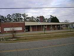 Berlin City Hall | |
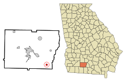 Location in Colquitt County and the state of Georgia | |
| Coordinates: 31°4′3″N 83°37′25″W / 31.06750°N 83.62361°WCoordinates: 31°4′3″N 83°37′25″W / 31.06750°N 83.62361°W | |
| Country | United States |
| State | Georgia |
| County | Colquitt |
| Area | |
| • Total | 0.7 sq mi (1.9 km2) |
| • Land | 0.7 sq mi (1.9 km2) |
| • Water | 0 sq mi (0 km2) |
| Elevation | 259 ft (79 m) |
| Population (2010) | |
| • Total | 551 |
| • Estimate (2016)[1] | 560 |
| • Density | 811/sq mi (313.2/km2) |
| Time zone | UTC-5 (Eastern (EST)) |
| • Summer (DST) | UTC-4 (EDT) |
| ZIP code | 31722 |
| Area code(s) | 229 |
| FIPS code | 13-07304[2] |
| GNIS feature ID | 0354554[3] |
Berlin is a city in Colquitt County, Georgia, United States. As of the 2010 census, the city had a population of 551.
History
Berlin was incorporated as a town in 1910.[4] A post office has been in operation at Berlin since 1910.[5] The community was named after Berlin, in Germany.[6] Upon American entry into World War I, the town was renamed "Lens" due to Anti-German hysteria.[6] The name "Berlin" was soon afterwards restored.[7]
According to the United States Census Bureau, the town has a total area of 0.8 square miles (2.1 km2), all land.
Demographics
| Historical population | |||
|---|---|---|---|
| Census | Pop. | %± | |
| 1930 | 250 | — | |
| 1940 | 322 | 28.8% | |
| 1950 | 309 | −4.0% | |
| 1960 | 419 | 35.6% | |
| 1970 | 422 | 0.7% | |
| 1980 | 538 | 27.5% | |
| 1990 | 480 | −10.8% | |
| 2000 | 595 | 24.0% | |
| 2010 | 551 | −7.4% | |
| Est. 2016 | 560 | [1] | 1.6% |
| U.S. Decennial Census[8] | |||
As of the census[2] of 2000, there were 595 people, 196 households, and 145 families residing in the town. The population density was 794.7 people per square mile (306.3/km²). There were 249 housing units at an average density of 332.6 per square mile (128.2/km²). The racial makeup of the town was 64.87% White, 11.93% African American, 1.68% Asian, 19.66% from other races, and 1.85% from two or more races. Hispanic or Latino of any race were 24.87% of the population.
There were 196 households out of which 40.3% had children under the age of 18 living with them, 57.7% were married couples living together, 13.3% had a female householder with no husband present, and 26.0% were non-families. 20.4% of all households were made up of individuals and 11.2% had someone living alone who was 65 years of age or older. The average household size was 2.84 and the average family size was 3.25.
In the town, the population was spread out with 27.7% under the age of 18, 16.0% from 18 to 24, 25.5% from 25 to 44, 19.7% from 45 to 64, and 11.1% who were 65 years of age or older. The median age was 29 years. For every 100 females, there were 104.5 males. For every 100 females age 18 and over, there were 107.7 males.
The median income for a household in the town was $33,438, and the median income for a family was $39,167. Males had a median income of $37,500 versus $20,536 for females. The per capita income for the town was $15,461. About 9.1% of families and 12.6% of the population were below the poverty line, including 9.3% of those under age 18 and 29.2% of those age 65 or over.
References
- 1 2 "Population and Housing Unit Estimates". Retrieved June 9, 2017.
- 1 2 "American FactFinder". United States Census Bureau. Archived from the original on 2013-09-11. Retrieved 2008-01-31.
- ↑ "US Board on Geographic Names". United States Geological Survey. 2007-10-25. Retrieved 2008-01-31.
- ↑ Acts and Resolutions of the General Assembly of the State of Georgia. 1910. p. 397.
- ↑ "Post Offices". Jim Forte Postal History. Retrieved 2 April 2018.
- 1 2 Krakow, Kenneth K. (1975). Georgia Place-Names: Their History and Origins (PDF). Macon, GA: Winship Press. p. 17. ISBN 0-915430-00-2.
- ↑
- ↑ "Census of Population and Housing". Census.gov. Archived from the original on April 22, 2013. Retrieved June 4, 2015.
External links

Municipalities and communities of Colquitt County, Georgia, United States | ||
|---|---|---|
| Cities | 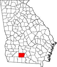 | |
| Towns | ||
| Unincorporated communities | ||
| Footnotes | ‡This populated place also has portions in an adjacent county or counties | |