Belthara Road
| Belthara Road BLTR | |
|---|---|
| Nagar Panchayat city | |
 Belthara Road Location in Uttar Pradesh, India | |
| Coordinates: 26°7′10.90″N 83°50′45.32″E / 26.1196944°N 83.8459222°ECoordinates: 26°7′10.90″N 83°50′45.32″E / 26.1196944°N 83.8459222°E | |
| Country |
|
| State | Uttar Pradesh |
| District | Ballia |
| Government | |
| • Type | Chairman |
| • Body | Individual |
| Population (2011)[1] | |
| • Total | 20,404 |
| Languages | |
| • Official | Hindi |
| Time zone | UTC+5:30 (IST) |
| PIN | 221715 |
Belthara Road is a Nagar Panchayat city[1] with a railway station in the north-western corner of Ballia district of Uttar Pradesh, India.[2]
Belthara Road is the sub district headquarters. District headquarters of the city is Ballia which is 60 km away.
Demographics
According to the 2011 census, in 2011 Belthara Road Nagar Panchayat had a population of 20,404 - 10,564 males and 9,840 females, giving a sex ratio of 931. There were 2476 children under 7 whilst the literacy rate of 85.78 % is much higher than the state average of 67.68 %. [1]
Areas
- Chaukia area has a population of 2600. There is a mosque.
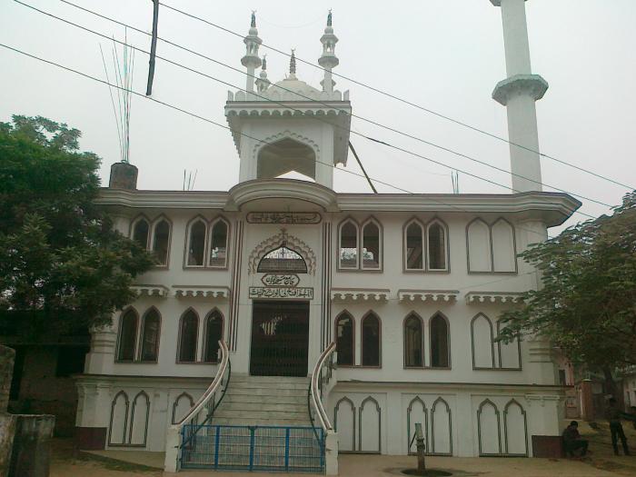
- The Bichla Pokhra area is the center of town. A Ramlila is presented each autumn, and Sarkari Primary School is in this area. There is a very big mosque named Jama Masjid. It is a very beautiful mosque.
- Chandair Walipur is around 7 km from Belthara raod, it is one of the most famous village around with population over 2000.
- Birhara is a small village. It is around 6 km from Belthra road, Sankat Mochan Hanuman temple one of the oldest temple in this region. Late Bala Singh was very well known person, his family belong to spartan community.
- Chaukia is a village 3 kilometres (1.9 mi) from the railway station.
- Patnari, with a population of over 1,000, is 3 km north of Belthara Road. The main occupations are agriculture and business.
- Chainpur Gulaura, also with a population of over 1,000, is 8 kilometres (5.0 mi) from the Belthara Road rail station. The main occupations are also agriculture and business.
- Buddhipur, with a population near 2000, it is one of the oldest villages in area. It has also an English medium school named St. Augusta School registered with CBSE board and managed by Mr. Vinod Pandey.
- Sasana Bahadur Pur is 8 km from the Belthara Road rail station, near the village of Akhop at the intersection of the Belthara road and Madhuban Highway.[3]
- Tirnai Khijirpur: Larger village, with a population of 3,000, 5 kilometres (3.1 mi) away.
- Babhnauli: Small village, about 10 kilometres (6.2 mi) from Belthara Road, inhabited mainly by Brahmin landowners. Well educated, some have moved to the United Kingdom.
- Rachhauli Small village about 12 kilometres (7.5 mi) from Belthara Road, primarily inhabited by well-educated Brahmins and Muslims. There are many small temples. An old shiv temple is exists in the middle of village.
- Bithuwa: This village incorporates almost half of Belthara Road. Public facilities include a bus station, post office, telephone exchange and hospital.There is also a madrasa, Madarsa Al-Gufran Darul Uloom. Bithuwa, with a population of about 1,500, is east of the bus station.
- Rampur Kanungoyan: This Kayastha village is 5 kilometres (3.1 mi) from the Belthara Road rail station, on the bank of a canal at Rasra-Belthara Road. Its high school also serves several neighbouring villages.
- Molanapur is a village with a temple, Shivalla. A nearby village is Tenua.
- Eksaray is an agricultural village.
- Farsatar, a village with a population of 2,000, is 3 kilometres (1.9 mi) to the south.
- Padri, a village of about 500 families, is 3 km northwest of the railway station on Sonadih Road and a few miles from the Ghaghara. Its northern and western sides are surrounded by a lake visited by birds during the monsoon. The village has several old temples.
- Kakrason is near Ubhaon Thana and the Sarayu. Kayasthas are the majority community.
- Telma Jamaludinpur: According to the 2011 Indian Census, its village code is 197832. Telma Jamaludinpur is 8.2 kilometres (5.1 mi) from the Belthara Road rail station. It has a Hindu majority and a Muslim minority, relying on agriculture. The 2.5-square-kilometre (0.97 sq mi) village, at an elevation of 84 m (276 ft) was founded in 1713 and had a population of 3,328 (1,709 males and 1,619 females) in 2011.
- Ubhaon: The village, with a population of 2,000 near the Ghaghra. There is also a very beautiful Mosque and a Madarsa.This village is also famous for Poice station Its police station is on the Gorakhpur-Bihar highway, you can get easily transport services from here. This is highly educated society and very clean area.
- Kundail Niyamat Ali, with a Muslim-majority population of about 10,000 and three mosques (including Jama Masjid), is 1 km west of Belthara Road.
- Shahpur Afghan, with a population of over 5,000, is 5.0 km east of Belthara Road and was founded about 450 years ago by Afghan troops.
- Baragoah- also known as piproli baragoah, it is about 5 km away from the nearest railway station,
- Banspar- also known as 'lucknow ka tukda'
Schools
- Nirmal jeevan Public school situated near Indouli Gram sabha.
- Nisva Junior high school Bahorva, BeltharaRoad ballia
- St. Xavier's school Belthara Road
- D. A. V. Inter college: One of the oldest schools in the town for sixth- to 12th-grade students, it is next to the rail station.
- G. M. A. M. Inter college: Another old school for sixth- to 12th-grade boys, it is also next to the rail station.
- Shayam Sundari Girls Inter College: Old school for sixth- to 12th-grade girls.
- Devendra P. G. Degree College: On the Belthara-Madhuban road
- NavJeevan English School: Secondary co-ed school
- M. M. D. Public School: Secondary co-ed school with dormitory facilities
- Green Lawns Public School Near Nagar Panchayat Office Belthra Road
- Fateh bahadur singh shivshankar singh mahavidyalay sasana bahadur pur
Attractions
- Indauli Famous Old temple of Lord Shiva & DIhbaba, Ramlila
The Bhageshwari temple, dedicated to the goddess of the same name, is between Ballia and Belthara Road and is the most-visited place of worship by local Hindus. A month-long annual fair, Sonadih Mela, is held here in conjunction with Navratri.[4] Another attraction is the Ghaghara. The Laxmi Narayan Picture Palace, in the main market, shows Bollywood and Hollywood films.In Centre a very big mosque name Jama Masjid...
References
- 1 2 3 "Belthara Road Population Census 2011". www.census2011.co.in. Retrieved 16 May 2016.
- ↑ "Maps of Belthara Road Tehsil villages in Ballia, Uttar Pradesh - villagemap.in". villagemap.in. Retrieved 5 May 2015.
- ↑ "Sasana Bahadurpur Pincode". pincodeaddress.com. Retrieved 5 May 2015.
- ↑ "Bhageshwari Temple (Sonadih, Ballia)". easternuptourism.com. Archived from the original on 25 May 2015. Retrieved 26 March 2016.