Belo sur Mer
| Belo sur Mer | |
|---|---|
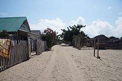 main road of Belo sur Mer | |
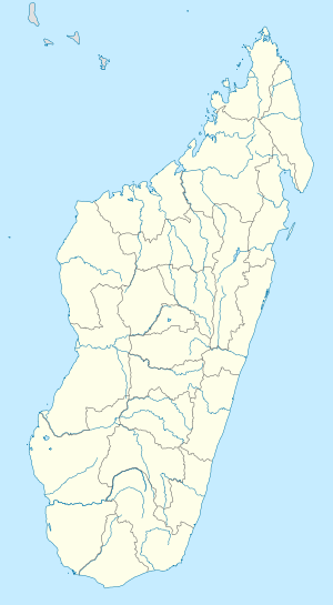 Belo sur Mer Location in Madagascar | |
| Coordinates: 20°44′S 44°0′E / 20.733°S 44.000°E | |
| Country |
|
| Region | Menabe |
| District | Morondava |
| Elevation[1] | 5 m (16 ft) |
| Population (2001)[2] | |
| • Total | 8,000 |
| Time zone | UTC3 (EAT) |
Belo sur Mer is a town and commune (Malagasy: kaominina) in Madagascar. It belongs to the district of Morondava, which is a part of Menabe Region. The population of the commune was estimated to be approximately 8,000 in 2001 commune census.[2]
Primary and junior level secondary education are available in town. It is also a site of industrial-scale mining. The majority 60% of the population of the commune are farmers. The most important crop is maize, while other important products are sweet potatoes and lima beans. Industry provides employment for 10% of the population. Additionally fishing employs 30% of the population.[2]
Economy
Belo sur mer is well known for its boatbuilders of traditional wooden dhows. There are also Salt evaporation ponds in the commune.[3]
Gallery
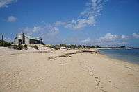 Beach & church
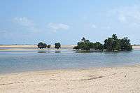 Mangroves
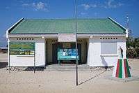 Town hall
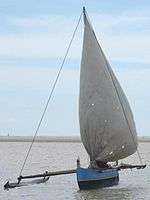 Outrigger boat
References and notes
- ↑ Estimated based on DEM data from Shuttle Radar Topography Mission
- 1 2 3 "ILO census data". Cornell University. 2002. Retrieved 2008-03-11.
- ↑ priori - Belo sur Mer (in French)
| Wikimedia Commons has media related to Belo sur Mer. |
| Belo sur Tsiribihina | 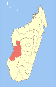 | |
|---|---|---|
| Mahabo | ||
| Manja | ||
| Miandrivazo | ||
| Morondava | ||