Bella Bella (Campbell Island) Airport
| Bella Bella (Campbell Island) Airport | |||||||||||||||||||
|---|---|---|---|---|---|---|---|---|---|---|---|---|---|---|---|---|---|---|---|
 | |||||||||||||||||||
| Summary | |||||||||||||||||||
| Airport type | Public | ||||||||||||||||||
| Operator | Heiltsuk Economic Development Corp | ||||||||||||||||||
| Serves | Bella Bella, British Columbia | ||||||||||||||||||
| Location | Campbell Island | ||||||||||||||||||
| Time zone | PST (UTC−08:00) | ||||||||||||||||||
| • Summer (DST) | PDT (UTC−07:00) | ||||||||||||||||||
| Elevation AMSL | 141 ft / 43 m | ||||||||||||||||||
| Coordinates | 52°11′06″N 128°09′24″W / 52.18500°N 128.15667°WCoordinates: 52°11′06″N 128°09′24″W / 52.18500°N 128.15667°W | ||||||||||||||||||
| Map | |||||||||||||||||||
 CBBC Location in British Columbia  CBBC CBBC (Canada) | |||||||||||||||||||
| Runways | |||||||||||||||||||
| |||||||||||||||||||
| Helipads | |||||||||||||||||||
| |||||||||||||||||||
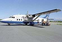
Bella Bella (Campbell Island) Airport (IATA: ZEL, TC LID: CBBC) is located 1 nautical mile (1.9 km; 1.2 mi) northwest of Bella Bella on Campbell Island. British Columbia, Canada. The airport is connected by paved road to the village of Bella Bella, British Columbia and forms a hub of sorts for the Central Coast, with flights linking to Klemtu, Port Hardy, and Vancouver with additional flights during the summer servicing tourist and commercial operations in the area.
Considered a halfway point for small aircraft flying from Seattle, Washington to Alaska, this airport offers a rest and refuel point for many pilots. GPS and NDB approaches are available. Daylight operations only.
Airlines
| Airlines | Destinations |
|---|---|
| Pacific Coastal Airlines[3] | Campbell River, Comox, Klemtu, Port Hardy, Vancouver |
See also
References
- ↑ Canada Flight Supplement. Effective 0901Z 19 July 2018 to 0901Z 13 September 2018.
- ↑ Synoptic/Metstat Station Information Archived June 28, 2013, at the Wayback Machine.
- ↑ Pacific Coastal Airlines: Schedules. Retrieved February 2015
External links
| By name | |
|---|---|
| By location indicator | |
| By province/territory | |
| By area | |
| National Airports System | |
| Related | |
| |
This article is issued from
Wikipedia.
The text is licensed under Creative Commons - Attribution - Sharealike.
Additional terms may apply for the media files.