Beeley
Coordinates: 53°12′13″N 1°36′16″W / 53.2035°N 1.6044°W
| Beeley | |
|---|---|
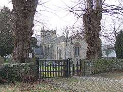 St Annes Church, Beeley | |
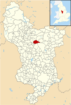 Beeley parish highlighted within Derbyshire | |
| Population | 195 (2011) |
| OS grid reference | SK264673 |
| District | |
| Shire county | |
| Region | |
| Country | England |
| Sovereign state | United Kingdom |
| Post town | MATLOCK |
| Postcode district | DE4 |
| Police | Derbyshire |
| Fire | Derbyshire |
| Ambulance | East Midlands |
| EU Parliament | East Midlands |
Beeley is a village and civil parish in northern Derbyshire, England. Located near Bakewell in the Derbyshire Dales, it is situated on the B6012 road, between Rowsley and Edensor. The civil parish population at the 2011 Census was 195.[1]
It is part of the Peak District National Park, and has been part of the Chatsworth estate since the 18th century, when the Duke of Devonshire bought Beeley Hill Top and then much of the property piecemeal. Beeley Old Hall dates from the 17th century. On School Lane there is an outdoor centre called Dukes Barn.
See also
- Pilsley—another Chatsworth estate village
References
- ↑ "Civil Parish population 2011". Neighbourhood Statistics. Office for National Statistics. Retrieved 20 March 2016.
External links
| Wikimedia Commons has media related to Beeley. |
This article is issued from
Wikipedia.
The text is licensed under Creative Commons - Attribution - Sharealike.
Additional terms may apply for the media files.