Beaver, Washington
| Beaver, Washington | |
|---|---|
| Unincorporated community | |
 Location of Beaver in Washington  Beaver, Washington (the US) | |
| Coordinates: 48°03′26″N 124°20′51″W / 48.05722°N 124.34750°WCoordinates: 48°03′26″N 124°20′51″W / 48.05722°N 124.34750°W | |
| Country | United States |
| State | Washington |
| County | Clallam |
| Elevation[1] | 413 ft (126 m) |
| Time zone | UTC-8 (PST) |
| • Summer (DST) | UTC-7 (PDT) |
| ZIP code | 98305 |
| Area code(s) | 360 |
| FIPS code | 53-53009 |
| GNIS feature ID | 1527580[1] |
| Other names |
Pleasant Tyee[1] |
| [2] | |
Beaver is an unincorporated community in Clallam County, Washington, United States on the Olympic Peninsula.
Geography
Beaver is located at 48°03′26″N 124°20′51″W / 48.057299°N 124.347435°W (48.057299, -124.347435),[1] on US Highway 101 to the north of Forks, Washington. It is located just to the west of the boundary of the Olympic National Forest, on Lake Pleasant. Beaver is 413 feet (126 m) above sea level. Interfor Pacific a lumber mill located nearby,(Interfor Pacific mill is closed here) along with county park with a playground and boat launching facilities on Lake Pleasant. It is one of the wettest places in the contiguous U.S. with an annual precipitation value of 121 inches of rain.[3]
Climate
The climate in this area has mild differences between highs and lows, and there is adequate rainfall year-round. According to the Köppen Climate Classification system, Beaver has a marine west coast climate, abbreviated "Cfb" on climate maps.[4]
References
- 1 2 3 4 U.S. Geological Survey Geographic Names Information System: Beaver, Washington. Retrieved on 2008-08-23.
- ↑ "ZIP Code Lookup". Archived from the original on 2011-06-15. Retrieved 2008-08-23.
- ↑ weather.com
- ↑ Climate Summary for Beaver, Washington
Municipalities and communities of Clallam County, Washington, United States | ||
|---|---|---|
| Cities | 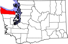 | |
| CDPs | ||
| Other unincorporated communities | ||
| Indian reservations | ||
| Ghost towns | ||