Beatrice, Alabama
| Beatrice, Alabama | |
|---|---|
| Town | |
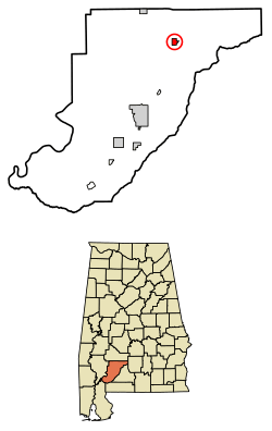 Location of Beatrice in Monroe County, Alabama. | |
| Coordinates: 31°43′59″N 87°12′24″W / 31.73306°N 87.20667°W | |
| Country | United States |
| State | Alabama |
| County | Monroe |
| Area[1] | |
| • Total | 1.35 sq mi (3.50 km2) |
| • Land | 1.35 sq mi (3.50 km2) |
| • Water | 0.00 sq mi (0.00 km2) |
| Elevation | 269 ft (82 m) |
| Population (2010) | |
| • Total | 301 |
| • Estimate (2017)[2] | 280 |
| • Density | 206.95/sq mi (79.92/km2) |
| Time zone | UTC-6 (Central (CST)) |
| • Summer (DST) | UTC-5 (CDT) |
| ZIP code | 36425 |
| Area code(s) | 251 |
| FIPS code | 01-04900 |
| GNIS feature ID | 0113705 |
| Website |
www |
Beatrice /biːˈætrɪs/ is a town in Monroe County, Alabama, United States. It incorporated in 1901.[3] At the 2010 census the population was 301, down from 412 in 2000.[4]
Geography
Beatrice is located at 31°43′59″N 87°12′24″W / 31.73306°N 87.20667°W (31.733178, -87.206773).[5]
According to the U.S. Census Bureau, the town has a total area of 1.4 square miles (3.6 km2), all land.
Demographics
| Historical population | |||
|---|---|---|---|
| Census | Pop. | %± | |
| 1910 | 345 | — | |
| 1920 | 293 | −15.1% | |
| 1930 | 342 | 16.7% | |
| 1940 | 410 | 19.9% | |
| 1950 | 375 | −8.5% | |
| 1960 | 506 | 34.9% | |
| 1970 | 455 | −10.1% | |
| 1980 | 558 | 22.6% | |
| 1990 | 454 | −18.6% | |
| 2000 | 412 | −9.3% | |
| 2010 | 301 | −26.9% | |
| Est. 2017 | 280 | [2] | −7.0% |
| U.S. Decennial Census[6] 2013 Estimate[7] | |||
As of the census[8] of 2000, there were 412 people, 158 households, and 106 families residing in the town. The population density was 304.8 people per square mile (117.8/km2). There were 203 housing units at an average density of 150.2 per square mile (58.1/km2). The racial makeup of the town was 26.94% White, 72.57% Black or African American, 0.24% Native American and 0.24% Pacific Islander. 0.49% of the population were Hispanic or Latino of any race.
There were 158 households out of which 32.9% had children under the age of 18 living with them, 36.1% were married couples living together, 25.3% had a female householder with no husband present, and 32.3% were non-families. 29.7% of all households were made up of individuals and 18.4% had someone living alone who was 65 years of age or older. The average household size was 2.61 and the average family size was 3.17.
In the town, the population was spread out with 28.9% under the age of 18, 9.7% from 18 to 24, 20.6% from 25 to 44, 21.4% from 45 to 64, and 19.4% who were 65 years of age or older. The median age was 38 years. For every 100 females, there were 89.0 males. For every 100 females age 18 and over, there were 84.3 males.
The median income for a household in the town was $15,833, and the median income for a family was $15,625. Males had a median income of $30,417 versus $15,469 for females. The per capita income for the town was $8,661. About 39.6% of families and 44.4% of the population were below the poverty line, including 54.5% of those under age 18 and 29.2% of those age 65 or over.
Notable people
- Butch Avinger, former NFL player
- Thad McClammy, politician
References
- ↑ "2017 U.S. Gazetteer Files". United States Census Bureau. Retrieved Jul 7, 2018.
- 1 2 "Population and Housing Unit Estimates". Retrieved March 24, 2018.
- ↑ http://www.encyclopediaofalabama.org/article/h-3588
- ↑
- ↑ "US Gazetteer files: 2010, 2000, and 1990". United States Census Bureau. 2011-02-12. Retrieved 2011-04-23.
- ↑ "U.S. Decennial Census". Census.gov. Archived from the original on May 12, 2015. Retrieved June 6, 2013.
- ↑ "Annual Estimates of the Resident Population: April 1, 2010 to July 1, 2013". Retrieved June 3, 2014.
- ↑ "American FactFinder". United States Census Bureau. Archived from the original on 2013-09-11. Retrieved 2008-01-31.
External links
Coordinates: 31°43′59″N 87°12′24″W / 31.733178°N 87.206773°W
Municipalities and communities of Monroe County, Alabama, United States | ||
|---|---|---|
| City | 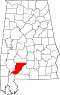 | |
| Towns | ||
| CDPs | ||
| Unincorporated communities | ||
| Ghost town | ||