Beata Island
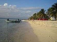 Beata's shore | |
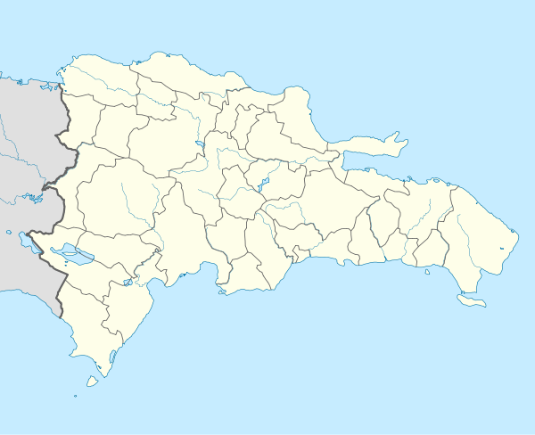 Beata Beata Island (Dominican Republic) | |
| Geography | |
|---|---|
| Coordinates | 17°34′42″N 71°30′42″W / 17.57833°N 71.51167°WCoordinates: 17°34′42″N 71°30′42″W / 17.57833°N 71.51167°W |
| Area | 27 km2 (10 sq mi) |
| Administration | |
|
Dominican Republic | |
| Province | Pedernales Province |
| Demographics | |
| Population | 10 (2010) |
| Pop. density | 0 /km2 (0 /sq mi) |
Beata Island (Spanish: Isla Beata) is a small island on the Caribbean Sea, located 7 km (4 mi) southwest from Cape Beata. Some 12 km (7 mi) SW of it lies the smaller Alto Velo Island. It is part of the Dominican Republic and is roughly triangle-shaped and fairly flat, with an approximate area of 27 km2 (10 sq mi).
History
Beata Island was discovered by Europeans during the second voyage of Christopher Columbus in 1494. Originally populated by Taíno natives, the island became a colonial asset of the greater Spanish Empire. The island was the site of various military engagements between the Spanish and roving pirates.
Geography
The landscape is somewhat varied, with mangrove swamps on parts of the North shore, sandy coves and beaches on the West coast. Most of the interior of the island is covered by various subtypes of xeric semi-deciduous limestone forests. Geologically, the island is basically made out of limestone, the erosion of which causes very jagged surfaces on exposed rocks (called diente de perro or dogtooth), and several sinkholes and cenotes. Beata Island is currently unhabitated, save for short stays by fishermen from the mainland.