Bear River City, Utah
| Bear River City, Utah | |
|---|---|
| City | |
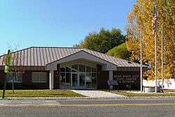 Bear River City Civic Center and Offices | |
 Location in Box Elder County and the state of Utah. | |
 Location of Utah in the United States | |
| Coordinates: 41°36′55″N 112°7′32″W / 41.61528°N 112.12556°WCoordinates: 41°36′55″N 112°7′32″W / 41.61528°N 112.12556°W | |
| Country | United States |
| State | Utah |
| County | Box Elder |
| Settled | 1866 |
| Incorporated | September 22, 1885 |
| Became a city | November 3, 2000 |
| Founded by | Anne Anderson |
| Named for | Bear River |
| Area | |
| • Total | 1.6 sq mi (4.1 km2) |
| • Land | 1.6 sq mi (4.1 km2) |
| • Water | 0.0 sq mi (0.0 km2) |
| Elevation[1] | 4,258 ft (1,298 m) |
| Population (2016) | |
| • Total | 869 |
| • Density | 477.5/sq mi (184.4/km2) |
| Time zone | UTC-7 (MST) |
| • Summer (DST) | UTC-6 (MDT) |
| ZIP code | 84301 |
| Area code(s) | 435 |
| FIPS code | 49-03950[2] |
| GNIS feature ID | 1438487[1] |
Bear River City is a city in Box Elder County, Utah, United States. The population was 853 at the 2010 census, an increase over the 2000 population of 750. The population was sufficient under Utah state law for Bear River to become a city near the end of 2000.[3] Although current state law requires a minimum population of 1000 for cities,[4] Bear River City remains a city.
Bear River City was first settled by a group from Brigham City in 1866.[5] The city took its name from the nearby Bear River.[6]
Demographics
| Historical population | |||
|---|---|---|---|
| Census | Pop. | %± | |
| 1870 | 317 | — | |
| 1880 | 340 | 7.3% | |
| 1890 | 321 | −5.6% | |
| 1900 | 390 | 21.5% | |
| 1910 | 648 | 66.2% | |
| 1920 | 490 | −24.4% | |
| 1930 | 436 | −11.0% | |
| 1940 | 429 | −1.6% | |
| 1950 | 438 | 2.1% | |
| 1960 | 447 | 2.1% | |
| 1970 | 445 | −0.4% | |
| 1980 | 540 | 21.3% | |
| 1990 | 700 | 29.6% | |
| 2000 | 750 | 7.1% | |
| 2010 | 853 | 13.7% | |
| Est. 2016 | 869 | [7] | 1.9% |
| U.S. Decennial Census[8] | |||
As of the census[2] of 2000, there were 750 people, 226 households, and 195 families residing in the town. The population density was 477.5 people per square mile (184.4/km²). There were 233 housing units at an average density of 148.4 per square mile (57.3/km²). The racial makeup of the town was 96.27% White, 0.27% Native American, 2.27% from other races, and 1.20% from two or more races. Hispanic or Latino of any race were 3.87% of the population.
There were 226 households out of which 46.9% had children under the age of 18 living with them, 78.8% were married couples living together, 6.6% had a female householder with no husband present, and 13.3% were non-families. 12.4% of all households were made up of individuals and 7.1% had someone living alone who was 65 years of age or older. The average household size was 3.32 and the average family size was 3.64.
In the town the age distribution of the population shows 36.7% under the age of 18, 8.0% from 18 to 24, 25.6% from 25 to 44, 19.3% from 45 to 64, and 10.4% who were 65 years of age or older. The median age was 30 years. For every 100 females, there were 110.1 males. For every 100 females age 18 and over, there were 100.4 males.
The median income for a household in the town was $52,212, and the median income for a family was $55,833. Males had a median income of $40,417 versus $24,821 for females. The per capita income for the town was $17,296. None of the population or families were below the poverty line.
Geography
According to the United States Census Bureau, the town has a total area of 1.6 square miles (4.1 km²), all of it land.
Major landmarks
Schools
Century Elementary holds about 800 students. They are done remodeling the school. There are new classrooms (for the 5th graders who were in portables), a new bathroom, and a new library.
Churches
There is one church that is owned by The Church of Jesus Christ of Latter-day Saints.
Parks
The town park is located east of the church. It includes two playing fields, a playground, a small rodeo arena, an outdoor stage, a volleyball court, and a small shop used on special occasions. The town park is cared for by a local family.
Historical buildings
There are two buildings in excess of 100 years old - an old town hall that was formerly a post office, and an old shop. There is an original pioneer log cabin, probably built in the 1850s, which serves as a museum and sits within the boundaries of the town park. This museum can be visited by appointment. At least one home which sits on the corner north east of the town park was built on remnants of the original Bear River Fort.
Retail locations
The Country Archer's, usually called The Little Store by locals, is the only retail shop.
Government buildings
The current post office is the third one that has existed in Bear River City. The original post office became the old town hall, and the second burned down.
See also
References
- 1 2 U.S. Geological Survey Geographic Names Information System: Bear River City
- 1 2 "American FactFinder". United States Census Bureau. Archived from the original on 2013-09-11. Retrieved 2008-01-31.
- ↑ Trauntvein, Myrna (December 9, 2000). "Mona is now a third-class city". Deseret News. p. A18. Retrieved May 25, 2011.
- ↑ §10-2-301 Archived 2013-10-17 at the Wayback Machine. of the Utah Code, accessed May 11, 2008
- ↑ Andrew Jensen. Encyclopedic History of the Church. p. 50
- ↑ The Utah Genealogical and Historical Magazine, Volumes 9-10. 1918. p. 12.
- ↑ "Population and Housing Unit Estimates". Retrieved June 9, 2017.
- ↑ "Census of Population and Housing". Census.gov. Archived from the original on May 12, 2015. Retrieved June 4, 2015.
External links
| Wikimedia Commons has media related to Bear River City, Utah. |
Places adjacent to Bear River City, Utah | ||||||||||
|---|---|---|---|---|---|---|---|---|---|---|
| ||||||||||
Municipalities and communities of Box Elder County, Utah, United States | ||
|---|---|---|
| Cities | 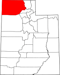 | |
| Towns | ||
| CDPs | ||
| Unincorporated areas | ||
| Ghost towns | ||
| Indian reservation | ||