Bear Mountain (Kern County, California)
| Bear Mountain | |
|---|---|
| Highest point | |
| Elevation | 6,916 ft (2,108 m) NAVD 88[1] |
| Prominence | 2,600 ft (792 m) [2] |
| Coordinates | 35°12′17″N 118°38′17″W / 35.204779653°N 118.638074522°WCoordinates: 35°12′17″N 118°38′17″W / 35.204779653°N 118.638074522°W [1] |
| Geography | |
| Location | Kern County, California, U.S. |
| Parent range | Tehachapi Mountains |
| Topo map | USGS Bear Mountain |
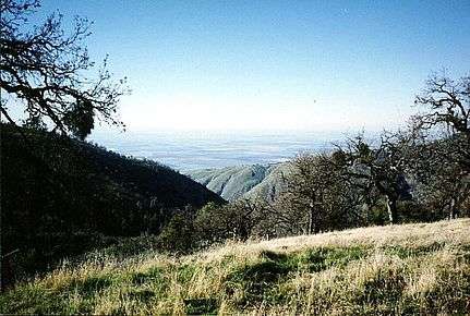
Looking West From Bear Mountain
Bear Mountain is a peak in the Tehachapi Mountains, near Tehachapi, California.
The mountain is north of Bear Valley Springs, and west of the Tehachapi Loop, a spiral on the railroad line through Tehachapi Pass.
Much of the mountain is on land owned by the Keene Ranch.
References
- 1 2 "Bear". NGS data sheet. U.S. National Geodetic Survey. Retrieved 2009-03-06.
- ↑ "Bear Mountain, California". Peakbagger.com. Retrieved 2009-07-01.
External links
| Wikimedia Commons has media related to Tehachapi Mountains. |
- "Bear Mountain". Geographic Names Information System. United States Geological Survey. Retrieved 2009-03-06.
This article is issued from
Wikipedia.
The text is licensed under Creative Commons - Attribution - Sharealike.
Additional terms may apply for the media files.