Bear Mountain (Carbon County, Pennsylvania)
| Bear Mountain[1] | |
|---|---|
 | |
| Highest point | |
| Peak | Knob nearest Lehigh[1] |
| Elevation | 1,673 ft (510 m) |
| Coordinates | 40°52′25″N 75°41′58″W / 40.87361°N 75.69944°WCoordinates: 40°52′25″N 75°41′58″W / 40.87361°N 75.69944°W |
| Dimensions | |
| Length | 10 mi (16 km) West-southwest-to-East-northeast |
| Width | 6.5–12.5 km (4.0–7.8 mi) north-south [2] |
| Geography | |
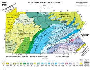
 Bear Mountain, Like Mauch Chunk (Jim Thorpe) is just off this map on the next one east
| |
| Country | United States |
| State | Pennsylvania |
| Borders on | Poconos and Great Appalachian Valley |
| Geology | |
| Orogeny | Ridge-and-Valley Appalachians, Appalachian Mountains |
| Age of rock | Silurian ??? |
| Type of rock | Tuscarora Formation ??? and Shawangunk Formation; sedimentary ??? |
Bear Mountain, in the Lehigh Valley of Pennsylvania several miles above the Lehigh Gap, is an steep-sided east bank ridgeline running about 9.96 miles (16.03 km) between the hairpin turn in the Lehigh the Lenape Amerindian people (Delaware people) visualized as a Bear's snout, along many water gap gorges, to the steep face dropping down to the Penn Forest Reservoir.[3][4] The sparsely settled mountain ridge is part of the ridge-and-valley Appalachians, oriented ENE towards the Delaware River climbing rapidly from the Lehigh left bank shoreline from about 580 feet (180 m)[5] over an overhanging knob opposite the mouth of Mauch Chunk Creek to more than 1,200 feet (370 m) in less than 1.01 miles (1.63 km) and to over 1,480 feet (450 m) in just 1.34 miles (2.16 km) the tourism & business district of Jim Thorpe. Bear Mountain is the prominent peak opposite the business district of the tourist attractions of Jim Thorpe in Carbon County, once termed being in the heart of "Switzerland of the United States". The former township and borough of East Mauch Chunk was settled outside the hustle and confusion of cross-river boomtown Mauch Chunk[6] ited on the north Overlooking the long slack water pool of the Lehigh River after it exits the wilderness countryside around the Lehigh Gorge as the Lehigh runs along the northwest flanks of Bear Mountain,
Notes
References
- 1 2 "Bear Mountain". Geographic Names Information System. United States Geological Survey. Retrieved 2016-12-10.
- ↑ Google maps, 6.5 miles Penn Haven Junction SE to throat of Interstate I-476 as it climbs along watercourse.
- ↑ The Penn Forest Reservoir is within a nature preserve, part of the Bethlehem Municipal Water Authority due south of Albrightsville.
- ↑ Distance from Google topo map anchored: Left side, on the east river bank, elevation ca 580 feet (180 m) just off the water; Ridge right limit: on knob where Hatchery Road crosses the 1,120 feet (340 m) elevation line (Lehighton, PA 40.930056,-75.569044 per Google map).
- ↑ From topo map, consistent with known water heights of the Lehigh Canal, the upper dams of which are still in place.
- ↑ Letter by co-founder George Hauto in late December 1819, stated to a Pennsylvania State Rep. that Lehigh Navigation Company had built 40 buildings in the less than 18 months from commencing operations there. Various company officers and managers built homes across the upper pool instead of on company lands in upper Mauch Chunk.