Beadlam
| Beadlam | |
|---|---|
 Beadlam Beadlam shown within North Yorkshire | |
| Population | 229 (2011 census)[1] |
| OS grid reference | SE653846 |
| Civil parish |
|
| District | |
| Shire county | |
| Region | |
| Country | England |
| Sovereign state | United Kingdom |
| Post town | YORK |
| Postcode district | YO62 |
| Police | North Yorkshire |
| Fire | North Yorkshire |
| Ambulance | Yorkshire |
| EU Parliament | Yorkshire and the Humber |
| UK Parliament |
|
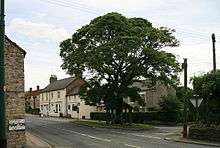
Beadlam is a village and civil parish in the Ryedale district of North Yorkshire, England. According to the 2001 census it had a population of 250, reducing to 229 at the Census 2011.[1] It is situated about 10 miles (16 km) west of Pickering, near the southern boundary of the North York Moors National Park.[2] Beadlam is halfway between Helmsley and Kirkbymoorside on the A170.

The village is unusual in that it is directly joined onto another village, Nawton, and is commonly given the name Nawton Beadlam. The village has a secondary school Ryedale School and Nawton, the village it is attached to, has a primary school, Nawton Primary School.
The village has a fish and chip shop, which is popular with the students returning from Ryedale School, and a bus stop which provides bus service connections to most of North Yorkshire including major cities and coastal towns in the area including York, Scarborough and Bridlington.
Beadlam was historically a township in the ancient parish of Kirkdale.[3] It became a separate civil parish in 1866,[4] but remains part of the ecclesiastical parish of Kirkdale. St Gregory's Minster, the parish church in Kirkdale, has been in use since before the Norman Conquest. Its daughter church of St Helen's in Beadlam, built in 1882-3, serves as the church of a local Ecumenical Partnership between Methodists and Anglicans.[5]
Two miles west of the village is Beadlam Roman villa which was excavated in 1969 revealing two 4th century rectangular buildings the northernmost of which was fitted with a hypocaust overlain by a tessellated floor.[6]
References
- 1 2 UK Census (2011). "Local Area Report – Beadlam Parish (1170217216)". Nomis. Office for National Statistics. Retrieved 12 March 2018.
- ↑ "Nawton and Beadlam Parish Plan" (PDF). Nawton and Beadlam Parish Council. 2004. Retrieved 1 November 2016.
- ↑ Page, William, ed. (1914). "Parishes: Kirkdale". Victoria County History. A History of the County of York North Riding: Volume 1. Institute of Historical Research. Retrieved 25 August 2014.
- ↑ Vision of Britain
- ↑ "St Hilda's Beadlam Nawton". A Church Near You. 2014. Retrieved 25 August 2014.
- ↑ "BEADLAM VILLA". 2010. Archived from the original on 6 February 2012. Retrieved 29 February 2012.
External links
![]()