Baure, Nigeria
| Baure | |
|---|---|
| LGA and town | |
 Baure Location in Nigeria | |
| Coordinates: 12°47′N 8°46′E / 12.783°N 8.767°ECoordinates: 12°47′N 8°46′E / 12.783°N 8.767°E | |
| Country |
|
| State | Katsina State |
| Area | |
| • Total | 707 km2 (273 sq mi) |
| Population (2006 census) | |
| • Total | 197,425 |
| Time zone | UTC+1 (WAT) |
| 3-digit postal code prefix | 824 |
| ISO 3166 code | NG.KT.BU |
Baure is a Local Government Area in Katsina State, Nigeria, sharing a border with the Republic of Niger. Its headquarters are in the town of Baure in the northwest of the area at 12°50′10″N 8°44′47″E / 12.83611°N 8.74639°E.
It has an area of 707 km² and a population of 197,425 at the 2006 census.
The postal code of the area is 824.[1]
References
- ↑ "Post Offices- with map of LGA". NIPOST. Archived from the original on 7 October 2009. Retrieved 2009-10-20.
State capital: Katsina | ||
| Local Government Areas | 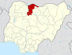 | |
This article is issued from
Wikipedia.
The text is licensed under Creative Commons - Attribution - Sharealike.
Additional terms may apply for the media files.