Barmouth Bridge
| Barmouth Bridge Pont Abermaw | |
|---|---|
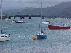
 View of the bridge from Barmouth | |
| Coordinates | 52°42′50″N 4°02′20″W / 52.714°N 4.039°WCoordinates: 52°42′50″N 4°02′20″W / 52.714°N 4.039°W |
| Carries | Rail traffic, pedestrians |
| Crosses | Afon Mawddach |
| Locale | Gwynedd, Wales |
| Heritage status | Grade II* listed |
| Characteristics | |
| Total length | 699 metres (764 yd) |
| History | |
| Opened | 1867 |
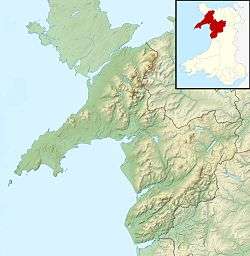 Barmouth Bridge Location within Wales  Barmouth Bridge Barmouth Bridge (the United Kingdom) | |
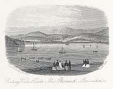
Barmouth Bridge (Welsh: Pont Abermaw), also known as Barmouth Viaduct is a Grade II* listed single-track wooden railway viaduct across the River Mawddach estuary near Barmouth, Wales. The 699 metres (764 yd) crossing carries the Cambrian Line. It is the longest timber viaduct in Wales and one of the oldest still in regular use in Britain.
The Barmouth Bridge was designed by and constructed for the Aberystwyth and Welsh Coast Railway Company for their route between Aberystwyth and Pwllheli. Work was authorised during 1861 and commenced during 1864. On 10 October 1867, the completed bridge was officially opened. Following the discovery of severe corrosion on underwater sections of ironwork, an intensive restoration programme was performed between December 1899 and late 1902. By 1980, the structure was found to be under attack by marine woodworm, which led to concerns that the bridge may have to be closed and demolished. However, in part due to its value to local tourism, it was instead repaired during 1985 and 1986, which included a six month closure. Since 2005, weight restriction on the bridge have been relaxed, allowing locomotive-hauled trains to cross it for the first time in two decades.
The bridge, which lies between Morfa Mawddach and Barmouth in Gwynedd, is used by rail and, cyclists and pedestrians. It is part of the National Cycle Network. To allow the passage of tall ships, the Barmouth Bridge originally incorporated a drawbridge, which was replaced between 1899 and 1902 by a swing bridge; however, this is no longer operationally used due to a lack of demand. There is no provision for the carriage of road traffic. Prior to 2013, tolls were collected for both foot and cycle traffic; the bridge has run a voluntary toll since 2017.
Location and overview
The Barmouth Bridge crosses the estuary of the River Mawddach from Morfa Mawddach near Arthog northwards to the edge of Barmouth.[1] The line is operated by Arriva Trains Wales, who provide connecting services south to Aberystwyth and east to Welshpool and Shrewsbury.[2] The section containing the bridge is on the Cambrian Coast railway between Machynlleth and Pwllheli.[3] The bridge has a length of 699 metres (764 yd),[4][5] possessing a structure comprising 113 wooded trestles, supported by a series of cast iron piers. As of the present day, it is one of the longest timber viaducts still standing in Britain,[4][6] and has been recognised as being a Grade II* listed structure.[7]
A footbridge is incorporated on the eastern side and pedestrians, cyclists and motorcycles can cross the estuary by the side of the track.[5] Since 1996, this has formed part of the National Cycle Route that links North and South Wales.[1] The footbridge is owned by national railway infrastructure manager Network Rail, however, an agreement is in place with Gwynedd County Council, who contribute 10 per cent of the structure’s annual maintenance in exchange for a licence to use the bridge.[8]
The majority of the bridge is built on top of a gravel bed, covered by shifting sand. The northern end of the structure, which is where the swing bridge is located, is next to the rock of Figle Fawr at the base of the Rhinogydd Range of mountains. The river channel here can reportedly flow at a rate of up to 9 knots (16.7 km/h). The first two spans of this end are built directly onto the rock upon cylindrical piers composed of cast iron.[4] The iron swing bridge section, which had replaced the original drawbridge implimentation,[9] was last opened during April 1987. Since then, the installation of continuous rails across the movable section prevent its movement, and thus the passage of tall ships in and out of the estuary.[10]
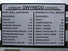
The Barmouth Bridge makes no accommodation for road vehicles, nor is there any nearby crossing for such traffic. The nearest road bridge to span the Afon Mawddach is a toll bridge located at Penmaenpool about 5 miles (8 km) further upstream, which permits vehicles up to 2.5 tonnes. Heavier vehicles must use the first public road bridge, which is located at the town of Dolgellau, about 10 miles (16 km) from Barmouth.[11]
History
Background and construction
The Barmouth Bridge has its origins in proposals issued by the Aberystwith and Welsh Coast Railway Company, who sought to establish a new coastal railway between the city of Aberystwyth and the town of Pwllheli.[4] During 1861 - 2, authorisation for the line’s construction was received, permitting the detailed design and construction phases to commenced thereafter. The bridge was a key feature for traversing the estuary of the River Mawddach.[4]
The design of the Barmouth Bridge was produced by the civil engineers Benjamin Piercy and Henry Conybeare.[4] Reportedly, Conybeare had decided upon the adoption of a timber viaduct configuration on the basis of a determination that it would be cheaper to import this material from the Baltic by sea than it otherwise would have been to construct an iron-based equivalent, which is believed to have been estimated to have had a cost of around four times more.[4] The decision was also influenced by an incorrect belief that the estuary was free from marine borers, which would attack and weaken the timber over time. During this era, timber pile viaducts were a commonplace feature of coastal railways, particularly those in Wales, although the bridge at Barmouth would be longer than most ever built.[4]
During 1864, construction commenced upon the structure.[4] The contractor for its construction was a Thomas Savin, while the ironwork was produced by John Cochrane & Sons. Early on, progress was hindered by the strong tidal currents present in the estuary, which was attributed for multiple failed attempts as to sinking the hollow cylinders for the bridge’s piers, which were initially performed by workmen on board barges.[4] Instead, between March and June 1866, another approach in the form of staging built out from the northern abutment for the bridge was used for sinking the tubes, after which they were filled with concrete after establishing with certainty that the cylinders had been bedded into the rock below.[4]
The piers for the trestles are founded on screw piles, which had a width of 250-360mm along with screw discs 915mm in diameter, and arranged in groups of three piles per pier.[4] Timber trellis girders, which have a length of 12.2 meters and depth of 1.2 meters, support the bridge’s deck, whereas driven piles comprise the fenders. Originally, the water around the trestles had a maximum depth of 16.5 meters during spring tides; subsequently, the river bed was raised via stone tipping to afford greater protection to the piles.[4]
On 3 June 1867, horse-drawn carriages were ran across the viaduct. On 10 October 1867, the completed bridge was officially opened, after which point steam-hauled train services commenced.[4]
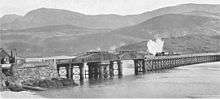
As originally built, the viaduct included a 14.3 meter-long wooden lifting drawbridge section towards its northern end, which was incorporated to permit the passage of tall ships through the estuary.[4] The drawbridge span, which was carried on top of wrought iron piles, opened by tilting and sliding back over the track, being rolled on an arrangement of four 1.2 meter wheels, spaced 15.2 meters apart, and nine steel rollers. When opened, it provided a gap that was 11 meters long between fenders.[4] However, this drawbridge would never see regular use as a result of the opening of the railway, which had effectively eliminated all competition from traditional boat traffic, somewhat negating its necessity and purpose.[12]
Operational life

During August 1899, the chief engineer of the Cambrian Railways, Alfred Jones Collin, ordered a series of underwater inspections, performed by divers, to check on the integrity of the drawbridge span’s ironwork.[4] These inspections discovered that the supports for the section had severely corroded, undermining its structural integrity and necessitating the replacement of almost all ironwork, save for two piers. Consequently, remedial repairs were enacted while a temporary speed limit of 8kph (5mph), and late on 3.2kph (2mph), was put in place until their completion.[4]
Work on the bridge started in December 1899, and was completed by the end of 1902.[4] The drawbridge arrangement was entirely replaced with a swing bridge counterpart, which is still in place to this day. This consisted of a single steel swing span, 41.5 meters in length, which rotates around a central pivot, adjacent to a 36 meter-long fixed span.[4] These spans are hogback lattice trusses, supported via pairs of cylindrical iron piers, while the turntable is by secured by a cluster of four similar piers. Presently, while the swing bridge mechanism is intact and still theoretically capable of operation, though it has not been opened since 1987 as part of a test operation, the rails crossing the structure are now continuous over the ends of the movable span, which would prevent any movement being performed without change.[4]
During 1946, the Barmouth bridge was nearly destroyed after a live naval mine was washed ashore close to the bridge during stormy weather. According to reports, the mine had briefly swept past one of the pillars, but did not detonate, thus the bridge escaped unscathed from the near-disaster.[13]

As a result of the Beeching cuts of the 1960s, passenger train services over the bridge declined significantly after the closure of the Ruabon to Barmouth line via Llangollen and Dolgellau in 1965, causing all traffic to take the longer and slower route from Shrewsbury via Machynlleth and Dovey Junction instead.[4] The old trackbed from Morfa Mawddach railway station to Dolgellau now forms the Mawddach Trail, a walk and cycle trail.[14]
By 1980, the bridge's structure had come under attack from marine woodworm, the resulting damage from which was serious enough threaten its closure.[15] nationalised railway operator British Rail discovered that woodworm had eaten into 69 of the structure’s supporting pillars and had estimated that it would cost around £2.5 million to repair.[16] Locomotive-hauled trains were banned, which immediately resulted in the loss of traffic from Tywyn, including explosives traffic to and from the factory at Penrhyndeudraeth. That traffic was re-routed via Maentwrog Road railway station and the Conwy Valley Line.[17] However, Gwynedd County Council were opposed to closing the bridge completely as 40% of all railway traffic in the area was tourist related.[15] The government applied for a £2.5 million grant from the European Economic Community (EEC) to finance repairs to the bridge,[18] along with a further £4.6 million that was spent on signalling improvements upon the line itself.[15] The bridge was closed entirely to traffic for six months during the temporary repair works eventually undertaken, and 30 of the piles were replaced.[16]
On 13 April 1986, a British Rail Class 37 diesel locomotive number 37427 was named "Bont Y Bermo" to celebrate the re-introduction of locomotive-hauled trains following repairs in 1985–1986. However, this proved to be short-lived and the practice of locomotive-hauled trains was soon effectively forbidden as a result of weight restrictions being imposed upon all traffic using the bridge. Following the completion of major repairs, the weight restriction on the bridge was relaxed in 2005, and locomotive-hauled trains have once again been allowed to cross it.[19]
During March 2013, the Barmouth Viaduct Access Group (B-VAG), was established to investigate an alternative route from the town centre to the bridge, as the current walkway is steep, narrow, and unsuitable for buggies or wheelchairs.[20] In June, the toll was removed after the collectors left and were not replaced. The council have not yet decided how to pay for the bridge's maintenance costs, which were £39,405 for the year.[5] This has proved to be problematic as the revenue collected from tolls has not been sufficient to cover the council's share of costs, and there is not a sufficient budget to employ any full-time staff to collect payments.[8]
Gwynedd County Council has proposed closing the bridge to pedestrians and cyclists for cost reasons, as it needs to find £9 million worth of savings by April 2016. The potential closure of the bridge is one of over 100 cost saving options totalling £13 million to be put to a public consultation in Autumn 2015; the council currently pays Network Rail £30,800 per year towards maintenance costs. A petition calling on the council to "cease considerations of closing this much loved walking and cycling route" attracted 20,000 signatures within a week.[21][22] In February 2016, it was reported that the bridge would not close.[23]
On 4 October 2016, Barmouth Bridge had to be closed to all traffic for a week following the outbreak of a fire on the structure.[24] The day after the incident, local MP Liz Saville Roberts lobbied for the speedy renovation of the bridge as a matter of urgency.[25]
The viaduct celebrated its 150th anniversary during October 2017, during which a fireworks display was performed and special charter trains were ran.[26] The same month, Bill Kelly, the chief operating officer of Network Rail Wales, spoke of ambitions to spend around £20 million to secure the long-term future of Barmouth Bridge between 2019 and 2024.[27] In late 2017, an "honesty toll" of £1 for adults and 50p for children was introduced with a troll mascot, and the old toll house rebranded as a "troll house".[28]
See also
- List of bridges in Wales
- Pont Briwet, a former 19th-century timber viaduct built by the Aberystwith and Welsh Coast Railway.
References
Citations
- 1 2 Gwynedd County Council 2013, p. 1.
- ↑ "Cambrian Line". Arriva Trains Wales. Archived from the original on 9 October 2014. Retrieved 6 October 2014.
- ↑ "Cambrian Coast Railway Line". Aberystwyth Town Council. Retrieved 6 October 2014.
- 1 2 3 4 5 6 7 8 9 10 11 12 13 14 15 16 17 18 19 20 21 22 "Barmouth Viaduct". Engineering Times. Archived from the original on 15 October 2014. Retrieved 9 October 2014.
- 1 2 3 "Barmouth Bridge in Gwynedd toll-free as staff leave". BBC News. 11 June 2013. Retrieved 6 October 2014.
- ↑ Breverton, Terry (2012). Wales: A Historical Companion. Amberley Publishing Limited. p. 54. ISBN 978-1-4456-0990-4.
- ↑ "Barmouth Railway Bridge,(Partly in Arthog Community) Barmouth Bridge, Barmouth Date Listed: 22 March 1988 Cadw Building ID: 5207". British Listed Buildings. Retrieved 10 April 2016.
- 1 2 Gwynedd County Council 2013, p. 2.
- ↑ Clemens 2003, Trial opening, 19 mins from start.
- ↑ "Continuous rails across the bridge". www.google.com/maps. 3 January 2018.
- ↑ Green, Jim (2000). Holy Ways of Wales. Y Lolfa. p. 117. ISBN 978-0-86243-519-6.
- ↑ Hollingsworth, John Brian (1982). Atlas of the World's Railways. Bison. p. 72.
- ↑ "Barmouth Viaduct". Western Morning News. 23 April 1946. p. 2. Retrieved 8 November 2014 – via British Newspaper Archive. (Subscription required (help)).
- ↑ "Mawddach Trail". Snowdonia National Park Authority. Archived from the original on 15 October 2014. Retrieved 9 October 2014.
- 1 2 3 Evan Evans, Lord Mountevans (26 February 1986). "Settle/Carlisle Railway: Proposed Closure". Retrieved 7 October 2014.
- 1 2 Pearce, Fred; Hamer, Mick (12 May 1983). "The Empire's Last Stand". New Scientist: 387. Retrieved 9 October 2014.
- ↑ Baughan, Peter (1991). North and Mid Wales, Volume 11 of Regional Railway History Series. David St. John Thomas. p. 246. ISBN 978-0-946537-59-4.
- ↑ "European Community Loans and Grants". Hansard. 30 June 1980. Retrieved 7 October 2014.
- ↑ "The Railway Magazine" (149). 2003: 57.
- ↑ "New harbour walkway planned for Barmouth". Cambrian News. 28 March 2013. Retrieved 9 October 2014.
- ↑ "20,000-name petition to keep Barmouth Bridge open to all". BBC News. 20 August 2015. Retrieved 21 August 2015.
- ↑ Devine, Darren (20 August 2015). "Fight to save Barmouth Bridge sees 20,000 sign petition within a week". Wales Online. Retrieved 21 August 2015.
- ↑ "Caernarfon and Barmouth bridges SAVED from the axe..." Daily post. 8 February 2016. Retrieved 1 June 2016.
- ↑ "Fire on Barmouth Bridge viaduct leads to rail disruption." BBC News, 4 October 2016.
- ↑ "Fire-hit Barmouth Bridge 'Renovations Urgent' says MP." Daily Post, 5 October 2016.
- ↑ "Crowds wowed by firework spectacle at Barmouth Bridge 150th anniversary celebrations". Daily Post Wales. 15 October 2017.
- ↑ "Barmouth Bridge £20m plan on its 150th anniversary". BBC News. 10 October 2017. Retrieved 17 August 2018.
- ↑ "Voluntary donation to 'troll' under bridge". Cambrian News. 22 December 2017. Retrieved 14 September 2018.
Bibliography
- Report to Cabinet : Barmouth Bridge (PDF) (Report). Gwynedd County Council. 11 June 2013. Retrieved 27 October 2016.
- Clemens, Jim (2003) [1959]. North Wales Steam Lines (DVD). The Jim Clemens Collection No.6. Uffington, Shropshire: B&R Video Productions. Vol 79.
External links
| Wikimedia Commons has media related to Barmouth Bridge. |