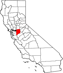
Banta, California
Banta is a small unincorporated community in San Joaquin County, California. Historically, it was a major interchange point between the Central Pacific and Southern Pacific railroads. It was located on the route of the transcontinental railroad from Sacramento to the San Francisco Bay Area by way of the Altamont Pass and Niles Canyon before the Central Pacific bought the route of the California Pacific which ran north of the Carquinez Strait to Vallejo. The Central Pacific diverted the California Pacific line to Benicia, California and established a railroad ferry between Benicia and Port Costa across the Carquinez Strait. Steve Perry, former lead singer of the band Journey, once called Banta his home. His Alien Project rock group formed here in the mid-1970s. The ZIP Code is 95304, and the community is inside area code 209.
Landmarks

Banta's historical sites include the Banta Inn, established in 1879. [1] The Inn is well known in the area because some local residents believe it to be haunted. [2]
For a brief period, Banta was a stop along the Lincoln Highway, the original cross-country thoroughfare linking the eastern and western United States.[3] The highway was rerouted past Banta to nearby Tracy in 1915 via Eleventh Street, which was also known as U.S. Highway 50 for many years.
The historic J. Brichetto Building at 5362 West G Street, on the corner of South 7th Street across from the Banta Inn, was constructed by local landowner Giuseppe Brichetto in 1911 and served as a general store and the town's post office for many years.[4]
Notable residents
- Steve Perry - former lead singer of the rock band Journey.
- Richard Pombo, former Congressman, also lived in Banta.
Government
In the California State Legislature, Banta is in the 5th Senate District, represented by Democrat Cathleen Galgiani, and in the 13th Assembly District, represented by Democrat Susan Eggman.[5]
In the United States House of Representatives, Banta is in California's 10th congressional district, represented by Republican Jeff Denham.[6]
References
- ↑ "Lincoln Highway's ghosts echo from many roads, byways". lincolnhighway.jameslin.name. Retrieved 2017-07-20.
- ↑ "Haunted Hotspots (CA)". 2008-02-04. Archived from the original on 2008-02-04. Retrieved 2017-07-20.
- ↑ "Luring the Lincoln Highway". 2015-07-17. Retrieved 2018-06-23.
- ↑ "Historic Banta store/post office closing for good". 2001-12-29. Retrieved 2017-07-20.
- ↑ "Statewide Database". UC Regents. Retrieved October 20, 2014.
- ↑ "California's 10th Congressional District - Representatives & District Map". Civic Impulse, LLC.
Coordinates: 37°45′16″N 121°22′11″W / 37.75444°N 121.36972°W
