Bansud, Oriental Mindoro
| Bansud | ||
|---|---|---|
| Municipality | ||
| Municipality of Bansud | ||
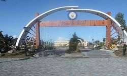 Municipal grounds | ||
| ||
 Map of Oriental Mindoro with Bansud highlighted | ||
.svg.png) Bansud Location within the Philippines | ||
| Coordinates: 12°50′00″N 121°22′00″E / 12.83333°N 121.36667°ECoordinates: 12°50′00″N 121°22′00″E / 12.83333°N 121.36667°E | ||
| Country |
| |
| Region | Mimaropa (Region IV-B) | |
| Province | Oriental Mindoro | |
| District | 2nd district | |
| Barangays | 13 (see Barangays) | |
| Government [1] | ||
| • Type | Sangguniang Bayan | |
| • Mayor | Ronaldo Mortel Morada | |
| • Electorate | 21,744 voters (2016) | |
| Area [2] | ||
| • Total | 343.47 km2 (132.61 sq mi) | |
| Population (2015 census)[3] | ||
| • Total | 40,992 | |
| • Density | 120/km2 (310/sq mi) | |
| Time zone | UTC+8 (PST) | |
| ZIP code | 5210 | |
| PSGC | 175202000 | |
| IDD : area code | +63 (0)43 | |
| Climate type | Tropical climate | |
| Income class | 2nd municipal income class | |
| Revenue (₱) | 123,346,761.65 (2016) | |
| Native languages |
Romblomanon Tagalog | |
| Website |
www | |

Bansud, officially the Municipality of Bansud, is a 2nd class municipality in the province of Oriental Mindoro, Philippines. According to the 2015 census, it has a population of 40,992 people.[3]
Bansud is 90 kilometres (56 mi) from Calapan.
Barangays
Bansud is politically subdivided into 13 barangays.
| Barangay | Population (2016) |
|---|---|
| Alcadesma | 2,184 |
| Bato | 842 |
| Conrazon | 4,105 |
| Malo | 1,875 |
| Manihala | 1,063 |
| Pag-Asa | 3,193 |
| Poblacion | 6,891 |
| Proper Bansud | 3,337 |
| Rosacara | 2,280 |
| Salcedo | 5,135 |
| Sumagui | 3,014 |
| Proper Tiguisan | 2,347 |
| Villa Pag-asa | 4,726 |
| Total | 40,992 |
Etymology
The name of the town is said to be derived from a legend. The legend says that long ago the Mangyans, the aborigines of the Mindoro settled in the lands near the mouth of Bansud River, which they called “Basud” which means Delta. The delta provided fertile soil for the people; hence they lived there peacefully and productively until the time that settlers from the province of Marinduque and Visayan Islands moved in. In many years that followed, the word “Basud” was eventually changed to Bansud.
Demographics
| Population census of Bansud | ||
|---|---|---|
| Year | Pop. | ±% p.a. |
| 1960 | 10,935 | — |
| 1970 | 17,492 | +4.80% |
| 1975 | 20,095 | +2.82% |
| 1980 | 22,614 | +2.39% |
| 1990 | 26,225 | +1.49% |
| 1995 | 31,901 | +3.74% |
| 2000 | 35,032 | +2.03% |
| 2007 | 35,664 | +0.25% |
| 2010 | 38,341 | +2.67% |
| 2015 | 40,992 | +1.28% |
| Source: Philippine Statistics Authority[3] [4] [5] [6] | ||
References
- ↑ "Municipality". Quezon City, Philippines: Department of the Interior and Local Government. Retrieved 31 May 2013.
- ↑ "Province: Oriental Mindoro". PSGC Interactive. Quezon City, Philippines: Philippine Statistics Authority. Retrieved 12 November 2016.
- 1 2 3 Census of Population (2015). "Region IV-B (Mimaropa)". Total Population by Province, City, Municipality and Barangay. PSA. Retrieved 20 June 2016.
- ↑ Census of Population and Housing (2010). "Region IV-B (Mimaropa)". Total Population by Province, City, Municipality and Barangay. NSO. Retrieved 29 June 2016.
- ↑ Censuses of Population (1903–2007). "Region IV-B (Mimaropa)". Table 1. Population Enumerated in Various Censuses by Province/Highly Urbanized City: 1903 to 2007. NSO.
- ↑ "Province of Oriental Mindoro". Municipality Population Data. Local Water Utilities Administration Research Division. Retrieved 17 December 2016.
External links
- Philippine Standard Geographic Code
- Philippine Census Information
- Local Governance Performance Management System
Places adjacent to Bansud, Oriental Mindoro | |
|---|---|