Greater Bandung
| Greater Bandung metropolitan area Kawasan metropolitan Bandung Raya | |
|---|---|
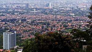 View of Central Bandung from the north | |
 | |
| Coordinates: 6°55′26″S 107°36′23″E / 6.92389°S 107.60639°ECoordinates: 6°55′26″S 107°36′23″E / 6.92389°S 107.60639°E | |
| Country |
|
| Province |
|
| Core city | Bandung |
| Satellite subregions |
Cimahi Bandung Regency West Bandung Regency |
| Area | |
| • Total | 3,280.27 km2 (1,266.52 sq mi) |
| Population (2015) | |
| • Total | 8,231,586 |
| • Density | 1,781.3/km2 (4,614/sq mi) |
| Time zone | UTC+7 (Indonesia Western Time) |
| Postcodes | 40xxx |
| Area codes | (62)22 |
| Vehicle sign | D |
| Website |
metropolitan |
| Highest elevation 2,608 m/8,556 ft (Mount Kendang, in Bandung Regency) | |
The Greater Bandung metropolitan area (Indonesian: Kawasan metropolitan Bandung Raya) is the metropolitan area surrounding the city of Bandung, West Java, Indonesia.[1] It was home to 8.5 million people in 2014 and is composed of regencies and cities previously part of the Dutch East Indies era Central Priangan Residency administration.
Due to ongoing development in urban areas between Bandung, Kertajati International Airport, Aerotropolis and Patimban International Seaport,[2] the West Java provincial government and the Regional Planning Board (BAPPEDA) has prepared and publicized a blueprint for a newly defined Bandung Metropolitan area; with a total area more than 5500 km2 and a population greater than 11 million people. The new metropolitan includes the entire Sumedang Regency with parts of Subang Regency and Majalengka Regency; and borders the Cirebon metropolitan area. Together, the two metro areas comprise over 14 million people.[3]
Location
Bandung is located in a mountainous plateau region in the central-west portion of West Java province and has the third highest population of any metropolitan area in Indonesia.
Western Java urban corridor
The Bandung metropolitan area begins less than 20 km from the eastern edge of the metropolitan area of Greater Jakarta ("Jabodetabek") near Cianjur city, and is adjacent (contiguous) with the Jabodetabekjur-Cirangkarta definition for Jakarta's extended metropolitan area at its northern border with Purwakarta Regency. Stretching from Serang Regency in Banten Province to include Greater Bandung, this urban corridor is home to over 44 million people.
Definition
The Bandung Metropolitan area is officially defined as covering Bandung Regency and West Bandung Regency (until 2007 part of Bandung Regency), together with the cities of Bandung and Cimahi.[1]
| Administrative division | Area (km²) 2005[4] | Population 2010 Census[5] | Population 2015 official estimate | Population density (/km² 2015) |
|---|---|---|---|---|
| Bandung City | 167.27 | 2,394,873 | 2,481,469 | 14,835 |
| Cimahi City | 39.27 | 541,177 | 586,580 | 14,937 |
| Bandung Regency | 1,767.96 | 3,178,543 | 3,534,114 | 1,999 |
| West Bandung Regency | 1,305.77 | 1,510,284 | 1,629,423 | 1,248 |
| Metropolitan area | 3,280.27 | 7,624,877 | 8,231,586 | 2,509 |
Sources: (Budan Pusat Statistik 2010, 2015 Census Indonesia)
- http://www.bps.go.id/hasilSP2010/jabar/3211.pdf (for kecamatan)
- https://web.archive.org/web/20120628013636/http://www.bps.go.id/aboutus.php?sp=0&kota=32 Tabel Hasil Sensus Penduduk 2010 Provinsi JAWA BARAT (for all others)
- https://web.archive.org/web/20131014170450/http://www.jabarprov.go.id/index.php/subMenu/75 Sumber : Database SIAK Provinsi Jawa Barat Tahun 2011
- (BPS Jabar 2015)Satudata Jawa Barat BPS Jumlah Penduduk Kabupaten/ Kota di Jawa Barat Tahun 2010 - 2015
- Note that area figures in Indonesia are frequently updated as the country is seismically and volcanically very active, and land subsidence due to changes in land use and population pressures. 3 kecamatan data were not updated, assuming no changes to older data from 2010 data.
Notes
- 1 2 http://werdhapura.penataanruang.net/dokuwiki/lib/exe/fetch.php/isu_strategis/bab_2_profil_wilayah_metropolitan_bandung.pdf
- ↑ Yoesoef Adji (April 26, 2016). "Pelabuhan Patimban Siap Gantikan Cilamaya".
- ↑ http://m.republika.co.id/berita/nasional/pemprov-jabar/15/04/06/nmd66t-jabar-kembangkan-tiga-kawasan-metropolitan
- ↑ "Archived copy". Archived from the original on 2013-12-30. Retrieved 2016-02-08. Indonesia.go.id: for area and http://www.jabarprov.go.id/jabar/public/85701/menu.htm?id=85701 Javabarat.go.id for population
- ↑ Publikasi Provinsi dan Kabupaten Hasil Sementara SP2010 Archived 2010-10-13 at the Wayback Machine.