Contramaestre, Cuba
| Contramaestre | |
|---|---|
| Municipality | |
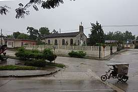 A church in Contramaestre | |
.png) Contramaestre municipality (red) within Santiago Province (yellow) and Cuba | |
 Location of Contramaestre in Cuba | |
| Coordinates: 20°18′0″N 76°15′2″W / 20.30000°N 76.25056°WCoordinates: 20°18′0″N 76°15′2″W / 20.30000°N 76.25056°W | |
| Country |
|
| Province | Santiago de Cuba |
| Area | |
| • Total | 610.3 km2 (235.6 sq mi) |
| Elevation | 110 m (360 ft) |
| Population (2004)[1] | |
| • Total | 101,832 |
| • Density | 166.9/km2 (432/sq mi) |
| Time zone | UTC-5 (EST) |
| Area code(s) | +53-226 |
Contramaestre (Spanish for "boatswain") is a Cuban town and municipality in the Santiago de Cuba Province.
Geography
The municipality is located in the western part of the province, neighboring the provinces of Granma and Holguín; and borders with the municipalities of Jiguaní, Urbano Noris, Palma Soriano and Tercer Frente. It counts the villages of Altos de Ventas, Anacahuita, America Libre, Baire, El Naranjo, Guaninao, La Maritonia, Laguna Blanca, Los Negros, Los Pasos, Maffo, Palo Seco, Pino de Baire, Pueblo Nuevo and Xavier.[2]
Demographics
In 2004, municipal population of Contramaestre was of 101,832,[1] of which 44,752 in the town. With a total area of 610 km2 (240 sq mi), it has a population density of 166.9/km2 (432/sq mi). Contramaestre is known as the land of citric.
Architectures
- Main Hospital: Orlando Pantoja Tamayo (22.July.1988)
- Elementary Schools: Jose de la Luz y Caballero. Semi-internado: Orlando Pantoja T.
- Secondary Schools: Pepito Tey. Rodolfo Rodríguez
- Public Library: Luz Berta Sánchez.
See also
References
- 1 2 Santiago.cu (2006). "Municipalities of Santiago de Cuba" (in Spanish). Archived from the original on 2007-12-15. Retrieved 2007-10-05.
- ↑ 5919047 Contramaestre on OpenStreetMap
External links
![]()