Tercer Frente
| Tercer Frente | |
|---|---|
| Municipality | |
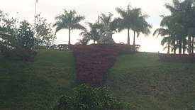 A mausoleum in Cruce de los Baños | |
.png) Tercer Frente municipality (red) within Santiago Province (yellow) and Cuba | |
 Location of Tercer Frente in Cuba | |
| Coordinates: 20°10′19″N 76°19′39″W / 20.17194°N 76.32750°WCoordinates: 20°10′19″N 76°19′39″W / 20.17194°N 76.32750°W | |
| Country |
|
| Province | Santiago de Cuba |
| Seat | Cruce de los Baños |
| Area | |
| • Total | 364.3 km2 (140.7 sq mi) |
| Elevation | 225 m (738 ft) |
| Population (2005)[1] | |
| • Total | 30,457 |
| • Density | 83.6/km2 (217/sq mi) |
| Time zone | UTC-5 (EST) |
| Area code(s) | +53-226 |
Tercer Frente (Spanish pronunciation: [teɾˈseɾ ˈfɾente], Spanish for "Third Front") is a municipality in the Santiago de Cuba Province of Cuba. It is centered on the town, and municipal seat, of Cruce de los Baños.
Geography
The municipality is located in the western part of the province, neighboring the province of Granma, and borders with the municipalities of Guisa, Jiguaní, Contramaestre, Palma Soriano and Guamá. It counts the town of Cruce de los Baños and the villages of El Yayal, Manaca and Matias.[2]
Demographics
In 2004, the municipality of Tercer Frente had a population of 30,457.[1] With a total area of 364 km2 (141 sq mi), it has a population density of 83.6/km2 (217/sq mi).
See also
References
- 1 2 Santiago.cu (2006). "Municipalities of Santiago de Cuba" (in Spanish). Archived from the original on 2007-12-15. Retrieved 2007-10-05.
- ↑ 5919056 Tercer Frente on OpenStreetMap
External links
![]()
This article is issued from
Wikipedia.
The text is licensed under Creative Commons - Attribution - Sharealike.
Additional terms may apply for the media files.