Bahr el Zeraf
| Bahr el Zeraf (Arabic: بَـحْـر الـزّرَاف) | |
| Bahr ez Zeraf, Giraffe River, Phou[1] | |
| River | |
| Name origin: from Arabic "Giraffe River" | |
| Country | South Sudan |
|---|---|
| State | Jonglei |
| Region | Central Upper Nile |
| Source | Sudd swamp |
| - coordinates | 7°30′N 30°48′E / 7.5°N 30.8°E |
| Source confluence | |
| - location | Zeraf Cuts, South Sudan |
| - coordinates | 7°46′05″N 30°34′01″E / 7.768°N 30.567°E |
| Mouth | White Nile |
| - location | New Fangak, South Sudan |
| - coordinates | 9°24′47″N 31°09′47″E / 9.413°N 31.163°ECoordinates: 9°24′47″N 31°09′47″E / 9.413°N 31.163°E |
 | |
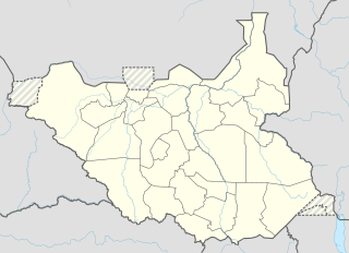 Location in South Sudan | |
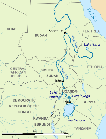
The Bahr el Zeraf (Arabic: بَـحْـر الـزّرَاف, translit. Baḥr ez-Zerāf, also spelt Bahr az-Zaraf, Bahr ez Zeraf, and Baḩr az Zarāf), or Zeraf River in the English language,[2] is an arm of the White Nile in the Sudd region of South Sudan. It is completely contained within the South Sudanese state of Jonglei. Its name is Arabic for "Giraffe River".[3]
Course
The Bahr el Zeraf forms in the southern Sudd wetlands as an arm of the Bahr al Jabal ("Mountain Nile") section of the White Nile. A pair of man-made canals known as the Zeraf Cuts were dug in 1910 and 1913[4] to connect the two rivers at 7°46′05″N 30°34′01″E / 7.768°N 30.567°E.[5] These canals divert some of the Jabal's flow, more than doubling the Zeraf's volume, with the intention of accelerating the flow to Egypt and thereby reducing the water "lost" to evaporation and transpiration in the swamps.[4]
From the Cuts the Zeraf flows north through the Ez Zeraf Game Reserve for 280 kilometres (170 mi). About 100 kilometres (62 mi) of this distance is through continuous swamp with islands, transitioning further downstream to a well-defined channel with raised banks.[4] The Zeraf rejoins the White Nile near New Fangak,[6] 80 kilometres (50 mi) downriver from Lake No and 56 kilometres (35 mi) upriver from Malakal.[7]
See also
References
- ↑ Action Contre la Faim (14 December 2006). "Sudan: Nutritional anthropometric survey, children under five years old - results summary Old Fangak Payam, Zeraf County, Jonglei State, Central Upper Nile". Retrieved 29 October 2013.
- ↑ Pease, A. E. (1909-10-16). The Book of the Lion. Ravenio Books.
- ↑ Baedeker, Karl (1914). Egypt and the Sûdân. p. 435.
- 1 2 3 Newhouse, Frederic. The training of the upper Nile,. Sir I. Pitnam & sons, ltd.
- ↑ Hughes, R. H.; Hughes, J. S. (1992). A directory of African wetlands ([Pbk. ed.]. ed.). Glan [u.a.]: IUCN [u.a.] ISBN 2880329493.
- ↑ Openstreetmap (Map). Openstreetmap contributors. 2013.
- ↑ "Bahr az-Zaraf". Encyclopædia Britannica Online Library Edition. Encyclopædia Britannica. Retrieved 2008-01-22.
External links
- Bahr el Zeraf (river), Getty Thesaurus of Geographic Names
- Baḩr az Zarāf, GEOnet Names Server