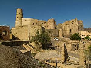
Bahla Fort
| UNESCO World Heritage site | |
|---|---|
 Bahla Fort | |
| Location | Bahla, Oman |
| Criteria | Cultural: (iv) |
| Reference | 433 |
| Inscription | 1987 (11th Session) |
| Endangered | 1988–2004[1] |
| Coordinates | 22°57′51″N 57°18′4″E / 22.96417°N 57.30111°ECoordinates: 22°57′51″N 57°18′4″E / 22.96417°N 57.30111°E |
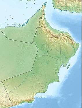 Location of Bahla Fort in Oman | |
Bahla Fort (Arabic: قلعة بهلاء; transliterated: Qal'at Bahla') is one of four historic fortresses situated at the foot of the Djebel Akhdar highlands in Oman and the country's only UNESCO-listed fort added in 1987.
The fort underwent massive restoration efforts and reopened in 2012. However, the complex lacks in visitor information. There are no exhibits or brochures available to learn more about this large space or guides at hand to provide further details so you have to either go on a tour or explore on your own.
History of Bahla Fort
The fort is believed to have been built between the 12th and 15th century by the Banu Nebhan tribe who inhabited the area at the time and were known for controlling the trade of frankincense at the time.
As part of the complex, there is also a citadel oasis adjacent to the fort and an ancient wall spanning 13 kilometres part of which are still standing. The majority of the oasis is in ruins but the structure and some of the houses still stand.
As the fort was built with bricks made of mud and straw, erosion damaged the structure until rehabilitation efforts were launched. There are a lot of legends surrounding the castle.
Structure of Bahla Fort
There are three main parts inside the fort. The oldest part of the fort is Al-Qasabah. Bait al-Hadith, or new house, was built by the Ya’riba dynasty (1624-1743). Bait Al-Jabal was erected in the 18th century.