Baft
| Baft بافت | |
|---|---|
| City | |
 Baft | |
| Coordinates: 29°13′59″N 56°36′08″E / 29.23306°N 56.60222°ECoordinates: 29°13′59″N 56°36′08″E / 29.23306°N 56.60222°E | |
| Country |
|
| Province | Kerman |
| County | Baft |
| Bakhsh | Central |
| Elevation | 2,280 m (7,480 ft) |
| Population (2016 Census) | |
| • Total | 34,517 [1] |
| Time zone | UTC+3:30 (IRST) |
| • Summer (DST) | UTC+4:30 (IRDT) |
| Area code(s) | 0347422 |
Baft (Persian: بافت, also Romanized as Bāft)[2] is a city and capital of Baft County, Kerman Province, Iran. Baft is located 155 kilometres (96 mi) southwest of Kerman. At the 2006 census, its population was 35,008, in 8,265 families.[3] Notably, Baft is one of the highest cities in Iran, at an elevation of about 2,267 metres (7,438 ft).[4]
Khabr National Park
Baft is one of the natural area in Iran. Within its local is the Khabr National Park which has been submitted by Iran as a UNESCO world heritage site.[5] Khabr National Park has a rich flora (about 750 species) and about 120 endemic species.
References
- ↑ https://www.amar.org.ir/english
- ↑ Baft can be found at GEOnet Names Server, at this link, by opening the Advanced Search box, entering "-3054465" in the "Unique Feature Id" form, and clicking on "Search Database".
- ↑ "Census of the Islamic Republic of Iran, 1385 (2006)". Islamic Republic of Iran. Archived from the original (Excel) on 2011-11-11.
- ↑
- ↑ UNESCO World Heritage Centre (2007) Khabr National Park and Ruchun Wildlife Refuge, web page, online at http://whc.unesco.org/en/tentativelists/5219/, visited 2015-03-28
| Capital | 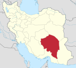 | |
|---|---|---|
| Counties and cities | ||
| Sights |
| |
| Places | ||
This article is issued from
Wikipedia.
The text is licensed under Creative Commons - Attribution - Sharealike.
Additional terms may apply for the media files.