Badin, North Carolina
| Badin, North Carolina | |
|---|---|
| Town | |
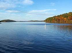 Badin Lake from the Badin boat launch. | |
| Motto(s): "A French-Flavored town at the foot of the Uwharries" | |
 Location of Badin, North Carolina | |
| Coordinates: 35°24′17″N 80°6′57″W / 35.40472°N 80.11583°WCoordinates: 35°24′17″N 80°6′57″W / 35.40472°N 80.11583°W | |
| Country | United States |
| State | North Carolina |
| County | Stanly |
| Area | |
| • Total | 1.6 sq mi (4.2 km2) |
| • Land | 1.6 sq mi (4.2 km2) |
| • Water | 0.0 sq mi (0.0 km2) |
| Elevation | 518 ft (158 m) |
| Population (2010) | |
| • Total | 1,974 |
| • Estimate (2016)[1] | 1,968 |
| • Density | 1,200/sq mi (470/km2) |
| Time zone | UTC-5 (Eastern (EST)) |
| • Summer (DST) | UTC-4 (EDT) |
| ZIP code | 28009 |
| Area code(s) | 704 |
| FIPS code | 37-02960[2] |
| GNIS feature ID | 1027372[3] |
| Website | www.badin.org |
Badin is a town located in Stanly County, North Carolina. At the 2010 census, the town had a total population of 1,974.
History
The Badin Historic District, Doerschuk Site, Hardaway Site, Narrows Dam and Power Plant Complex, and West Badin Historic District are listed on the National Register of Historic Places.[4]
Geography
Badin is located at 35°24'17" North, 80°6'57" West (35.404669, −80.115847).[5]
According to the United States Census Bureau, the town has a total area of 1.6 square miles (4.1 km2), of which, 1.6 square miles (4.1 km2) of it is land and none of the area is covered with water.
Demographics
| Historical population | |||
|---|---|---|---|
| Census | Pop. | %± | |
| 1950 | 2,126 | — | |
| 1960 | 1,905 | −10.4% | |
| 1970 | 1,626 | −14.6% | |
| 1980 | 1,514 | −6.9% | |
| 1990 | 1,481 | −2.2% | |
| 2000 | 1,154 | −22.1% | |
| 2010 | 1,974 | 71.1% | |
| Est. 2016 | 1,968 | [1] | −0.3% |
| U.S. Decennial Census[6] | |||
At the census[2] of 2000, there were 1,154 people, 494 households, and 328 families residing in the town. The population density was 719.2 people per square mile (278.5/km²). There were 586 housing units at an average density of 365.2 per square mile (141.4/km²). The racial makeup of the town was 63.26% White, 35.62% African American, 0.00% Native American, 0.00% Asian, 0.00% Pacific Islander, 0.17% from other races, and 0.95% from two or more races. 0.61% of the population were Hispanic or Latino of any race.
There were 494 households out of which 33.0% had children under the age of 18 living with them, 48.0% were married couples living together, 14.0% had a female householder with no husband present, and 33.6% were non-families. 31.2% of all households were made up of individuals and 17.8% had someone living alone who was 65 years of age or older. The average household size was 2.34 and the average family size was 2.91.
In the town, the population was spread out with 25.3% under the age of 18, 7.5% from 18 to 24, 26.8% from 25 to 44, 22.3% from 45 to 64, and 18.2% who were 65 years of age or older. The median age was 39 years. For every 100 females, there were 83.5 males. For every 100 females age 18 and over, there were 78.1 males.
The median income for a household in the town was $27,031, and the median income for a family was $32,692. Males had a median income of $27,396 versus $21,417 for females. The per capita income for the town was $15,320. 12.2% of the population and 9.4% of families were below the poverty line. 10.7% of those under the age of 18 and 17.1% of those 65 and older were living below the poverty line.
Economy
Badin's major employer was ALCOA, which operated a large facility in Badin until 2010. ALCOA laid off most of the workers when it shut down the factory in 2007. Alcoa Power Generating continues to generate electricity using four area dams and is working to find new uses for the plant site.
Notable people
- Star Jones, a former co-host of The View, a talk show on the American Broadcasting Company television network. She is also a former lawyer and prosecutor.
- Lou Donaldson, world-famous jazz musician and alto saxophonist.
References
- 1 2 "Population and Housing Unit Estimates". Retrieved June 9, 2017.
- 1 2 "American FactFinder". United States Census Bureau. Archived from the original on September 11, 2013. Retrieved 2008-01-31.
- ↑ "US Board on Geographic Names". United States Geological Survey. October 25, 2007. Retrieved 2008-01-31.
- ↑ National Park Service (2010-07-09). "National Register Information System". National Register of Historic Places. National Park Service.
- ↑ "US Gazetteer files: 2010, 2000, and 1990". United States Census Bureau. February 12, 2011. Retrieved 2011-04-23.
- ↑ "Census of Population and Housing". Census.gov. Archived from the original on May 12, 2015. Retrieved June 4, 2015.
External links
Municipalities and communities of Stanly County, North Carolina, United States | ||
|---|---|---|
| Cities | 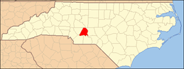 | |
| Towns | ||
| CDPs | ||
| Unincorporated communities | ||
| Footnotes | ‡This populated place also has portions in an adjacent county or counties | |