Băișoara
| Băișoara | |
|---|---|
| Commune | |
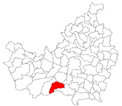 Location of the commune within Cluj County | |
 Location on Romania map | |
| Coordinates: 46°34′32″N 23°28′03″E / 46.57556°N 23.46750°ECoordinates: 46°34′32″N 23°28′03″E / 46.57556°N 23.46750°E | |
| Country |
|
| County | Cluj County |
| Status | Commune |
| Settled | 1426 |
| Commune seat | Băișoara |
| Villages | Băișoara, Frăsinet, Moara de Pădure, Muntele Băișorii, Muntele Bocului, Muntele Cacovei, Muntele Filii, Muntele Săcelului, Săcel |
| Government | |
| • Mayor | Minodora Susana Luca |
| Area | |
| • Total | 111.04 km2 (42.87 sq mi) |
| Population (July 1, 2007)[1] | |
| • Total | 2,338 |
| • Density | 21/km2 (55/sq mi) |
| Time zone | UTC+2 (EET) |
| • Summer (DST) | UTC+3 (EEST) |
| Area code(s) | +40 x64[2] |
| Website | http://www.cjcluj.ro/baisoara/ |
Băișoara (Hungarian: Járabánya; German: Kleingrub, Ginsdorf) is a commune in Cluj County, Romania. It is composed of nine villages: Băișoara, Frăsinet, Moara de Pădure, Muntele Băișorii (Bányahavas), Muntele Bocului (Bikalathavas), Muntele Cacovei (Havastelep), Muntele Filii (Felsőfülehavas), Muntele Săcelului (Asszonyfalvahavas) and Săcel (Havasasszonyfalva).
Since 2000, following important improvements of the local infrastructure it was officially declared a winter sports resort.
Demographics
According to the census from 2002 there was a total population of 2,330 people living in this town. Of this population, 97.51% are ethnic Romanians, 1.67% ethnic Romani and 0.72% are ethnic Hungarians.[3]
References
- ↑ "Population as of July 1, 2007" (in Romanian). INSSE. April 4, 2008. Archived from the original on 2010-01-17. Retrieved 2008-05-04.
- ↑ x is a digit indicating the operator: 2 for the former national operator, Romtelecom, and 3 for the other ground telephone networks
- ↑ Structura Etno-demografică a României

This article is issued from
Wikipedia.
The text is licensed under Creative Commons - Attribution - Sharealike.
Additional terms may apply for the media files.