Ayutla, San Marcos
| Ayutla | |
|---|---|
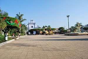 Main plaza and church in Ciudad Tecún Umán | |
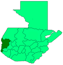
 Ayutla Location in Guatemala | |
| Coordinates: 14°40′41″N 92°08′31″W / 14.67806°N 92.14194°W | |
| Country |
|
| Department |
|
| Government | |
| • Mayor (2012-2020) | Erick Zúñiga[1] (UCN) |
| Climate | Aw |
Ayutla (Spanish pronunciation: [aˈʝutla]) is a municipality in the San Marcos Department of Guatemala. It is situated along the Suchiate River natural border with Mexico in the southern part of the department. The municipality center is Ciudad Tecún Umán. There is a combined road and rail bridge known as Puente Rodolfo Robles linking Ayutla to Ciudad Hidalgo in Chiapas, Mexico.[2]
There exists a railway, but because of poor maintenance nowadays it is not operational, but there are plans for its restoration.
Climate
Ayutla has tropical savanna climate (Köppen: Aw).
| Climate data for Ayutla | |||||||||||||
|---|---|---|---|---|---|---|---|---|---|---|---|---|---|
| Month | Jan | Feb | Mar | Apr | May | Jun | Jul | Aug | Sep | Oct | Nov | Dec | Year |
| Average high °C (°F) | 34.5 (94.1) |
34.9 (94.8) |
35.9 (96.6) |
35.8 (96.4) |
35.2 (95.4) |
33.7 (92.7) |
34.2 (93.6) |
34.3 (93.7) |
33.8 (92.8) |
33.8 (92.8) |
33.8 (92.8) |
33.9 (93) |
34.5 (94.1) |
| Daily mean °C (°F) | 27.1 (80.8) |
27.4 (81.3) |
28.7 (83.7) |
29.3 (84.7) |
29.2 (84.6) |
28.3 (82.9) |
28.5 (83.3) |
28.5 (83.3) |
28.3 (82.9) |
28.3 (82.9) |
27.8 (82) |
27.2 (81) |
28.2 (82.8) |
| Average low °C (°F) | 19.7 (67.5) |
20.0 (68) |
21.5 (70.7) |
22.8 (73) |
23.3 (73.9) |
22.9 (73.2) |
22.8 (73) |
22.7 (72.9) |
22.8 (73) |
22.8 (73) |
21.8 (71.2) |
20.5 (68.9) |
22 (71.5) |
| Average precipitation mm (inches) | 4 (0.16) |
1 (0.04) |
8 (0.31) |
53 (2.09) |
139 (5.47) |
293 (11.54) |
201 (7.91) |
205 (8.07) |
295 (11.61) |
225 (8.86) |
51 (2.01) |
6 (0.24) |
1,481 (58.31) |
| Source: Climate-Data.org[3] | |||||||||||||
Geographic location
Places adjacent to Ayutla, San Marcos | ||||||||||
|---|---|---|---|---|---|---|---|---|---|---|
| ||||||||||
See also


- San Marcos Department
- Rail transport in Central America
- Rail transport in Guatemala
- Rail transport in Mexico
References
- ↑ "San Marcos elige autoridades municipales". Prensa Libre (in Spanish). Guatemala. 8 September 2015. Retrieved 8 September 2015.
- ↑ Dr. Rodolpho Robles Bridge
- ↑ "Climate: Ayutla". Climate-Data.org. Retrieved 5 September 2015.
- 1 2 SEGEPLAN (n.d.). "Municipios del departamento de San Marcos". Secretaría General de Planificación (in Spanish). Archived from the original on 10 July 2015.
External links
![]()
Coordinates: 14°40′N 92°09′W / 14.667°N 92.150°W
This article is issued from
Wikipedia.
The text is licensed under Creative Commons - Attribution - Sharealike.
Additional terms may apply for the media files.