Aythorpe Roding
| Aythorpe Roding | |
|---|---|
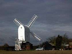 Aythorpe Roding windmill | |
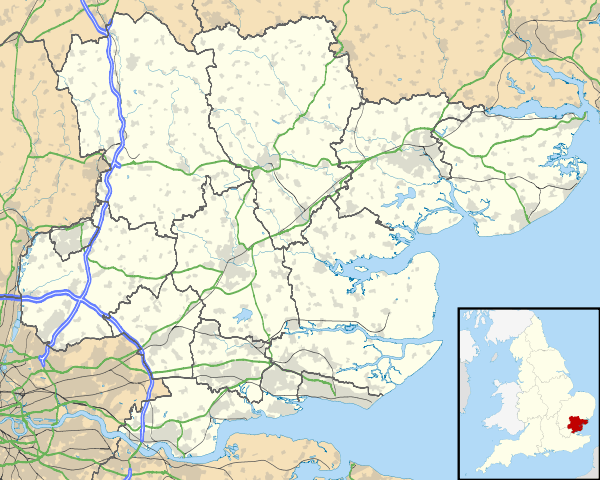 Aythorpe Roding Aythorpe Roding shown within Essex | |
| Population | 214 (2011)[1] |
| OS grid reference | TL584150 |
| Civil parish |
|
| District | |
| Shire county | |
| Region | |
| Country | England |
| Sovereign state | United Kingdom |
| Post town | DUNMOW |
| Postcode district | CM6 |
| Dialling code | 01279 |
| Police | Essex |
| Fire | Essex |
| Ambulance | East of England |
| EU Parliament | East of England |
| UK Parliament | |
Aythorpe Roding is a village and civil parish in the Uttlesford district of Essex, England. The village is included in the eight hamlets and villages called The Rodings. Aythorpe Roding is 9 miles (14 km) northwest from the county town of Chelmsford.
The parish is in the parliamentary constituency of Saffron Walden. Local governance is through its own parish council.[2]
Aythorpe Roding has a village hall and a cricket club.[2]
History
According to A Dictionary of British Place Names, Roding derives from "Rodinges" as is listed in the Domesday Book, with the later variation 'Roeng Aytrop' recorded in 1248. The 'Aytrop' refers to the manorial possession by a man called 'Aitrop' held under the ownership of the Abbess of Barking.[3]
In 1848 and 1882 the parish and village was known as Aythrop Roothing and was in the Dunmow Hundred. It was also in the Dunmow Union—poor relief provision set up under the Poor Law Amendment Act 1834—and part of the Rural Deanery of Roding. The registers of the church of St Mary the Virgin date to 1559. The parish living was a rectory with a parsonage, a small brick building, with 20 acres of glebe, being land used for the support of the incumbent. In 1848 the living was in the gift of the rector of Stondon Massey. The Lord of the Manor lived at Aythrop Roothing Hall. There were six principal landowners, including Gobert's Charity which owned the small Keeres Manor in the parish.[4][5]
Population in 1841 was 285, and in 1881, 237. Parish area in 1848 was 1,361 acres (5.5 km2), and in 1882, 1,393 acres (5.6 km2). Crops grown at the time were chiefly wheat, barley and beans, on a heavy soil with a clay subsoil. Parish occupations in 1848 included nine farmers, a beer retailer,a shopkeeper and a blacksmith. By 1882 the number of farmers included had reduced to five, with one being a landowner, the licensee of The Carpenters' Arms public house, a grocer & draper, the miller at the windmill, and a blacksmith.[4][5]
See also
References
- ↑ "Civil Parish population". Retrieved 28 September 2015.
- 1 2 "Uttlesford Information regarding Aythorpe Roding". www.uttlesford.gov.uk. Archived from the original on 27 September 2007. Retrieved 25 January 2007.
- ↑ Mills, Anthony David (2003); A Dictionary of British Place Names, Oxford University Press, revised edition (2011), p.392. ISBN 019960908X
- 1 2 White's Directory of Essex 1848
- 1 2 Kelly's Directory of Essex 1882 pp.245-247
External links

- Aythorpe Roding Church on Essex Churches website
- Aythorpe Roding Cricket Club website
- Aythorpe Roding Village Hall website