Axford, Wiltshire
| Axford | |
|---|---|
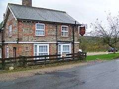 The Red Lion Inn | |
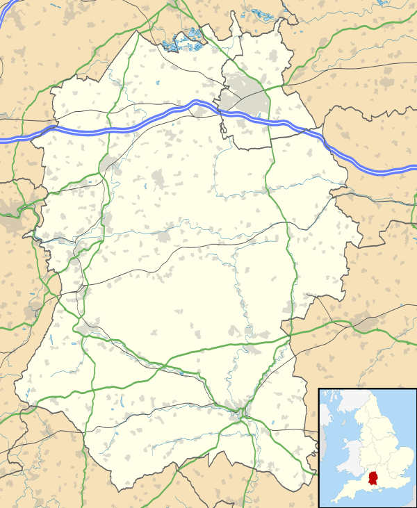 Axford Axford shown within Wiltshire | |
| OS grid reference | SU2370 |
| Civil parish |
|
| Unitary authority | |
| Ceremonial county | |
| Region | |
| Country | England |
| Sovereign state | United Kingdom |
| Post town | Marlborough |
| Postcode district | SN8 |
| Dialling code | 01672 |
| Police | Wiltshire |
| Fire | Dorset and Wiltshire |
| Ambulance | South Western |
| EU Parliament | South West England |
| UK Parliament | |
| Website | Ramsbury & Axford Community |
Axford is a hamlet in the Kennet Valley about 3 miles (4.8 km) east of Marlborough in the English county of Wiltshire.
History
Axford was one of seven Saxon settlements along the Kennet Valley in modern-day Wiltshire in the 5th and 6th centuries.[1]
During the 15th and 16th century, Axford Manor was centred on Priory Farm a short distance from the village itself. The majority of housing was built to the south of the main road through the village; the area to the north was developed during the late 18th and early 19th century.[2]
A military camp was located near Axford during the Second World War.[3]
Buildings
Axford contains one listed building; the Grade 1 listed Axford Farmhouse. A church is located in the village.[1] It also contains The Red Lion public house, a 17th-century building.[4]
Local government
Axford is in Ramsbury and Axford civil parish,[5] which is in the area of Wiltshire Council. The two councils are responsible for different aspects of local government.[6]
Transport
Axford is located a short distance from the A4 road.[4] Bus services to the village are provided by Swindon's Bus Company route 48 between Swindon and Marlborough.[7]
Position: grid reference SU238701
See also
References
- 1 2 Wiltshire County - Council Community and Parish information for Ramsbury Archived March 20, 2012, at the Wayback Machine.
- ↑ Chandler, John (2001). "Ramsbury Concise History". Marlborough and Eastern Wiltshire. Hobnob Press. ISBN 0-946418-07-1.
- ↑ Flying Troops to Camp The Leader Post, 1 September 1939
- 1 2 (From The Wiltshire Gazette and Herald)
- ↑ Ramsbury and Axford Parish Council, accessed 13 March 2013
- ↑ Kennet District Census Data from the Office for National Statistics, retrieved 19 Mar, 2006
- ↑ Thamesdown Transport - Timetables - Route 46/46A/48 Archived December 24, 2010, at the Wayback Machine.
External links
![]()