Aw Barre
| Aw Barre አወበሬ | |
|---|---|
| Town | |
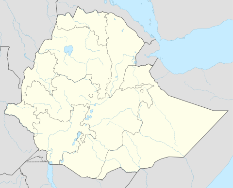 Aw Barre Location within Ethiopia | |
| Coordinates: 9°47′N 43°13′E / 9.783°N 43.217°ECoordinates: 9°47′N 43°13′E / 9.783°N 43.217°E | |
| Country |
|
| Region | Somali |
| Zone | Awbere (woreda), Faafan Zone |
| Elevation | 1,551 m (5,089 ft) |
| Population (2005) | |
| • Total | 35,977 |
| Time zone | UTC+3 (EAT) |
Aw Barre, also spelt Au Bare (Amharic: አወበሬ ) officially known as Teferi Ber[1] and called after its patron Saint Aw Barre[2] is a town in eastern Ethiopia located in the Fafan Zone of the Somali Region, near the border with Northern Somalia on the main trade route between Jijiga and the sea. It is the administrative center or the capital of Awubere woreda.
It was one of the biggest towns of the Adal Empire.[3][4] According to Ethiopian Christian folklore, this town was the only gateway that has caused fear for the Ethiopian Christian Kingdom, hence the name Teferi Ber, meaning "The Gate of Fear".[5]
The main trade route between Jijiga and the sea passes through Aw Barre; an ancient route to Zeila almost always went through Aw Barre. In 1962 it was described as a dry weather road. The Ethiopian News Agency reported in early 1998 that much khat was illegally smuggled out of Ethiopia by this route.[6]
When emperor Haile Selassie inspected the region in 1935 prior to the outbreak of the Second Italo-Ethiopian War, Haile Selassie made a secret two-day excursion to Aw Barre.[6] The Italian Giuda described Aw Barre in 1938 as a Somali village with about 1,000 inhabitants, whose houses were partly built of masonry, and possessing a mosque; a little to the west of the village was the tomb of the patron Saint Aw Barre.[7]
G.W.B. Huntingford noticed that whenever a historic site had the prefix Aw in its name (such as the ruins of Aw Barre), it denoted the final resting place of a local Saint.[8].
History
Aw Barre is one of the oldest continuously inhabited cities in Ethiopia, officially known as Teferi Ber [1] which in Amharic denotes the name of Ras Tafari Makonnen's (Ge'ez ልጅ፡ ተፈሪ፡ መኮንን) Gate of Fear, the only threat for the Abyssinian Christian Empire during the peak of power for the Muslim State of Adal.[5] Aw Barre was one of the biggest cities of the former Adal Empire. It is the final resting place of Sheikh Aw Barre whose tomb is located west of the town.[7]
Demographics
The town is inhabited by the Gadabuursi subclan of the Dir clan family. With the majority of the inhabitants belonging to the Faarah Nuur, one of the two sub divisions of Reer Nuur, a clan of the Makahiil Gadabuursi.[9] The town also has a sizeable population of the Reer Ugaas subclan of the Makayl-Dheere branch of the Makahiil Gadabuursi.[10] Based on figures from the Central Statistical Agency in 2005, Aw Barre of 35,977 inhabitants 18,978 are men and 16,999 are women.[11] The 1997 census reported this town had a total population of 24,125 of whom 12,538 were men and 11,587 women. 1994 Population and Housing Census of Ethiopia: Results for Somali Region, Vol. 1 Tables 2.4, 2.13 (accessed 10 January 2009). The results of the 1994 census in the Somali Region were not satisfactory, so the census was repeated in 1997.
Old Town of Aw Barre
Aw Barre is situated over 1,000 m above sea level. The old town contained over 200 houses, each built with stone walls and mason ranging from single room to multi-roomed courtyard houses. Niches were cut in the walls for storage, and they were roofed with brushwood laid over wooden rafters. The mosques were built much more ambitiously.[12]
Richard Francis Burton describes the old ruined town upon visitation as he passed by, in his book First Footsteps in East Africa (1856):
"Without returning the salutations of the Bedouins, who loudly summoned us to stop and give them the news, we trotted forwards in search of a deserted sheep-fold. At sunset we passed, upon an eminence on our left, the ruins of an ancient settlement, called after its patron Saint, Ao Barhe: and both sides of the mountain road were flanked by tracts of prairie-land, beautifully purpling in the evening air."[13]
Notes
- 1 2 Teferi Ber is the name used by the Central Statistical Agency in its Agricultural Sample Enumeration 2001-2002 (1994 E.C.): Report on Area and Production - Somali Region
- ↑ Burton, Richard (1856). First Footsteps in East Africa (1st ed.). Longman, Brown, Green, and Longmans. p. 384.
- ↑ Saints and Somalis: Popular Islam in a Clan-based Society
- ↑ , (accessed 25 December 2010)
- 1 2 Magaaladda Aw-Barre, source in Somali (accessed 12 October 2010)
- 1 2 "Local History in Ethiopia, Tefaw Lezer - Teru" The Nordic Africa Institute website (accessed 20 March 2009)
- 1 2 "Local History in Ethiopia, Asta Dega - Azzazzo" The Nordic Africa Institute website (accessed 20 November 2007)
- ↑ Huntingford, "The town of Amud, Somalia", Azania, (1978)
- ↑ Hayward, R. J.; Lewis, I. M. (2005-08-17). Voice and Power. Routledge. p. 136. ISBN 9781135751753.
The major town and region of the Rer Farah Nur, Aw Baare.
- ↑ http://www.ecoi.net/local_link/195229/313859_de.html
- ↑ CSA 2005 National Statistics, Table B.4
- ↑ , The archaeology of Islam in sub-Saharan Africa (accessed 20 December 2010)
- ↑ Burton, Richard (1856). First Footsteps in East Africa (1st ed.). Longman, Brown, Green, and Longmans. p. 384.