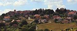
Avigliano Umbro
| Avigliano Umbro | ||
|---|---|---|
| Comune | ||
| Comune di Avigliano Umbro | ||
 | ||
| ||
.svg.png) Avigliano Umbro within the Province of Terni | ||
 Avigliano Umbro Location of Avigliano Umbro in Italy | ||
| Coordinates: 42°39′16.92″N 12°25′42.53″E / 42.6547000°N 12.4284806°ECoordinates: 42°39′16.92″N 12°25′42.53″E / 42.6547000°N 12.4284806°E | ||
| Country | Italy | |
| Region | Umbria | |
| Province | Terni (TR) | |
| Frazioni | Dunarobba, Santa Restituta, Sismano, Toscolano | |
| Government | ||
| • Mayor | Luciano Conti | |
| Area[1] | ||
| • Total | 51.32 km2 (19.81 sq mi) | |
| Elevation | 441 m (1,447 ft) | |
| Population (2011)[2] | ||
| • Total | 2,568 | |
| • Density | 50/km2 (130/sq mi) | |
| Demonym(s) | Aviglianesi | |
| Time zone | UTC+1 (CET) | |
| • Summer (DST) | UTC+2 (CEST) | |
| Postal code | 05020 | |
| Dialing code | 0744 | |
| Website | Official website | |

Avigliano Umbro is a comune (municipality) in the Province of Terni in the Italian region Umbria, located about 50 km south of Perugia and about 20 km northwest of Terni. As of 2011 census its population was of 2,568.[2]
The municipality borders with Acquasparta, Amelia Guardea, Montecastrilli, Montecchio, and Todi, this one in the Province of Perugia.[3]
References
- ↑ (in Italian) Avigliano Umbro on comuni-italiani.it
- 1 2 (in Italian) Source: Istat 2011
- ↑ 42112 Avigliano Umbro on OpenStreetMap
External links
| Wikimedia Commons has media related to Avigliano Umbro. |
- Official website (in Italian)
- Pro Loco Avigliano Umbro (Office of Tourism) (in Italian)
- Google. "Avigliano Umbro" (Map). Google Maps. Google.

| Authority control |
|---|
This article is issued from
Wikipedia.
The text is licensed under Creative Commons - Attribution - Sharealike.
Additional terms may apply for the media files.