Aures, Algeria
| Aures ⴰⵡⵔⴰⵙ Arabic: أَورَاس, translit. Awrās | |
|---|---|
| Natural region | |
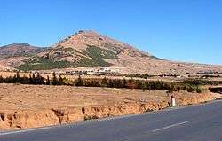 Landscape of the Aurès in Ras el Aïoun | |
 A map of northern Algeria showing the location of the Aures region in red and the greater region in green | |
| Country | Algeria |
| Elevation | 450 m (1,480 ft) |
Aures (Amazigh: ⴰⵡⵔⴰⵙ / Awras, Arabic: أَوْرَاس, translit. Awrās) is an Amazigh language-speaking natural region located in the mountainous area of the Aurès range in eastern Algeria. The region includes the Algerian provinces of Batna, Tebessa, Khenchela, Oum El Bouaghi, Souk Ahras and Biskra.
History
The Awras or Aures region is characterized both by its mountain terrain and by the Chaoui ethnic group that historically has inhabited the area. The rugged terrain of the Aurès made that the region became one of the less developed areas in the Maghreb. Traditionally the women of the region wore tattoos.[1]
It was in the Aures region that the Algerian War of Independence was started by Berber independence fighters such as Mostefa Ben Boulaïd who were operating from the area.[2] A district of Algeria that existed during and after the War of Independence, from 1962 to 1974, was named after this region.
See also
References
- ↑ Behind Algeria's Tattoos: A Portrait Series
- ↑ Algeria, 1830-2000: A Short History, p.
External links
Coordinates: 35°20′N 6°40′E / 35.333°N 6.667°E
| Wikimedia Commons has media related to Aurès. |
Cultural regions of Algeria | ||
|---|---|---|