Auma-Weidatal
| Auma-Weidatal | |
|---|---|
 Auma-Weidatal Location of Auma-Weidatal within Greiz district 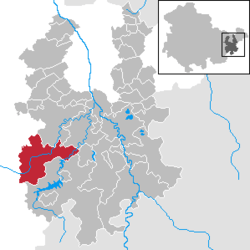 | |
| Coordinates: 50°42′N 11°54′E / 50.700°N 11.900°ECoordinates: 50°42′N 11°54′E / 50.700°N 11.900°E | |
| Country | Germany |
| State | Thuringia |
| District | Greiz |
| Area | |
| • Total | 55.75 km2 (21.53 sq mi) |
| Elevation | 394 m (1,293 ft) |
| Population (2017-12-31)[1] | |
| • Total | 3,557 |
| • Density | 64/km2 (170/sq mi) |
| Time zone | CET/CEST (UTC+1/+2) |
| Postal codes | 07955 |
| Dialling codes | 036626 |
| Vehicle registration | GRZ |
Auma-Weidatal (![]()
References
| Authority control |
|---|
This article is issued from
Wikipedia.
The text is licensed under Creative Commons - Attribution - Sharealike.
Additional terms may apply for the media files.