Auetal
| Auetal | |
|---|---|
 Auetal Location of Auetal within Schaumburg district 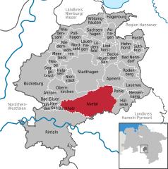  | |
| Coordinates: 52°14′02″N 9°14′14″E / 52.23389°N 9.23722°ECoordinates: 52°14′02″N 9°14′14″E / 52.23389°N 9.23722°E | |
| Country | Germany |
| State | Lower Saxony |
| District | Schaumburg |
| Government | |
| • Mayor | Thomas Priemer (SPD) |
| Area | |
| • Total | 62.15 km2 (24.00 sq mi) |
| Elevation | 192 m (630 ft) |
| Population (2017-12-31)[1] | |
| • Total | 6,287 |
| • Density | 100/km2 (260/sq mi) |
| Time zone | CET/CEST (UTC+1/+2) |
| Postal codes | 31749 |
| Dialling codes | 05752, 05753 |
| Vehicle registration | SHG |
| Website | www.auetal.de |
Auetal is a municipality in the district of Schaumburg, in Lower Saxony, Germany. It is situated approximately 10 km south of Stadthagen, and 22 km east of Minden. Its seat is in the village Rehren.
References
External links
| Authority control |
|---|
This article is issued from
Wikipedia.
The text is licensed under Creative Commons - Attribution - Sharealike.
Additional terms may apply for the media files.