Attapeu International Airport
| Attapeu International Airport | |||||||||||
|---|---|---|---|---|---|---|---|---|---|---|---|
| Summary | |||||||||||
| Airport type | Public | ||||||||||
| Owner | Lao government[1] | ||||||||||
| Serves | Attapeu | ||||||||||
| Location | Saysetha District, Laos | ||||||||||
| Elevation AMSL | 105 m / 345 ft | ||||||||||
| Coordinates | 14°47′35″N 107°02′43″E / 14.79306°N 107.04528°ECoordinates: 14°47′35″N 107°02′43″E / 14.79306°N 107.04528°E | ||||||||||
| Map | |||||||||||
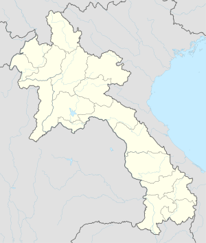 AOU Location in Laos | |||||||||||
| Runways | |||||||||||
| |||||||||||
|
Source: Great Circle Mapper[2] | |||||||||||
Attapeu International Airport (IATA: AOU, ICAO: VLAP) is an airport that serves Attapeu in Laos. It opened in May 2015 following two years of construction. Lao Airlines provided flights from Vientiane via Pakse three times a week; however, it stopped them in October 2016 because of low passenger demand. The airport is located in Attapeu Province, which borders Vietnam and has seen greater commercial activity; however, it does not receive much tourism.
History
On 11 February 2012, officials of the Lao and Vietnamese governments attended the groundbreaking ceremony for the airport, which is located near the Lao–Vietnamese border.[3] Construction began in May 2013 and ended in April 2015. Vietnam's Hoang Anh Gia Lai Group provided a loan of almost 300 billion kip (more than US$36.1 million) for the construction of the airport.[4] The Attapeu airport officially opened on 30 May 2015 as the first international facility in the province.[4][5]
In June 2015, TTR Weekly reported that neither of the two airlines providing domestic flights in Laos, Lao Airlines and Lao Skyway, had shown interest in serving Attapeu. Lao Airlines had conducted a year-long survey but found little interest. Although Attapeu Province has seen increased economic activity because of its proximity to Vietnam, it has few tourist attractions.[6]
Nevertheless, Lao Airlines introduced twice-weekly flights from Vientiane via Pakse on 9 April 2016.[7] The frequency was increased to thrice-weekly in July. However, Lao Airlines ended the route in October 2016 because of low passenger numbers.[1] The following January, authorities closed down the airport for the time being.[8][9]
Infrastructure
The Attapeu airport has one runway that measures 1,850 by 30 metres (6,070 ft × 98 ft). The 4,300-square-metre (46,000 sq ft) terminal can handle 300 passengers per day.[6]
Access
The airport is located along Route 18B in Saysetha District, roughly 28 kilometres (17 mi) from Attapeu.[4]
References
- 1 2 "Vientiane–Attapeu flights' wings clipped". Vientiane Times. 11 January 2017. Retrieved 15 January 2017.
- ↑ "AOU - Attopeu [Attopeu Airport], LA - Airport". Great Circle Mapper. Retrieved 15 January 2017.
- ↑ "State President wraps up Laos visit". Quảng Ninh provincial government. 13 February 2012. Retrieved 15 January 2017.
- 1 2 3 Latsaphao, Khonesavanh (18 October 2016). "Attapeu airport potential examined during PM's visit". Vientiane Times. Retrieved 15 January 2017.
- ↑ "Laos Attapeu International Airport 50% complete". Mena Report. 26 April 2014. Retrieved 15 January 2017.
- 1 2 Ngamsangchaikit, Wanwisa (15 June 2015). "No services to Attapeu airport". TTR Weekly. Retrieved 15 January 2017.
- ↑ "Vientiane–Attapeu flights starting to takeoff". Vientiane Times. 5 October 2016. Retrieved 15 January 2017.
- ↑ "Attapeu International Airport shuts down". The Laotian Times. 11 January 2017. Retrieved 2 October 2017.
- ↑ "Attapeu, Laos loses commercial service". ch-aviation. 11 January 2017. Retrieved 2 October 2017.