Arusha Rural District
| Arusha Rural District | |
|---|---|
| District | |
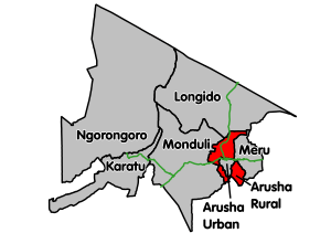 Arusha Rural District's location within Arusha Region. | |
| Coordinates: 03°15′38″S 36°38′28″E / 3.26056°S 36.64111°ECoordinates: 03°15′38″S 36°38′28″E / 3.26056°S 36.64111°E | |
| Country | Tanzania |
| Region | Arusha Region |
| Area[1] | |
| • Total | 1,547.6 km2 (597.5 sq mi) |
| Population (2012) | |
| • Total | 323,198 |
Arusha Rural District (or Arusha District Council) is one of the six districts of the Arusha Region of Tanzania. It is bordered to the north by Longido District, to the east by Meru District, to the south by Kilimanjaro Region, to the west by Monduli District, and it surrounds Arusha City.
According to the 2012 Tanzania National Census, the population of Arusha Rural District was 323,198.[2]
Transport
Paved Trunk road T2 from Kenyan border crossing at Kamanga to Moshi and paved trunk road T5 from Babati to Arusha pass through Arusha Rural District.[3]
Administrative subdivisions
As of 2012, Arusha Rural District was administratively divided into 21 wards.[2]
Wards
|
1.Bangata 2.Bwawani 3.Ilkiding'a 4.Oldonyomaasi 5.Kiranyi 6.Kisongo 7.Mateves |
8.Mlangarini 9.Moivo 10.Musa 11.Lemanyata 12.Mwandeti 13.Nduruma 14.Oldonyosambu 15.Oljoro 16.Laroi |
17.timbolo 18.Kiutu 19.Ilboru 20.Olmotonyi 21.Olorieni 22.Oltoroto 23.Oltrumet 24.Sambasha 25.Sokon II 26.Oldadai 27.Tarakwa |
Sources
References
- ↑ "Arusha District Council". Arusha Region Office, Tanzania. Archived from the original on 16 October 2016.
- 1 2 "Census 2012". National Bureau of Statistics. Archived from the original on 5 March 2016. Retrieved 16 February 2016.
- ↑ "Arusha Roads Network" (PDF). Tanroads. Retrieved 5 May 2016.