Arrondissement of Montluçon
| Montluçon | |
|---|---|
| Arrondissement | |
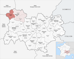 Location of the arrondissement in Auvergne-Rhône-Alpes | |
| Country | France |
| Region | Auvergne-Rhône-Alpes |
| Department | Allier |
| Communes | 89 |
| Subprefecture | Montluçon |
| Area¹ | |
| • Total | 2,117 km2 (817 sq mi) |
| Population (2014) | |
| • Total | 114,756 |
| • Density | 54/km2 (140/sq mi) |
| ¹ French Land Register data, which exclude lakes, ponds, and glaciers larger than 1 km² as well as the estuaries of rivers. | |
The arrondissement of Montluçon is an arrondissement of France in the Allier department in the Auvergne-Rhône-Alpes region. Since the January 2017 reorganization of the arrondissements of Allier, it has 89 communes.[1]
Composition
Cantons
The cantons of the arrondissement of Montluçon are (since 2015):
Communes
The communes of the arrondissement of Montluçon, and their INSEE codes, are:
- Ainay-le-Château (03003)
- Archignat (03005)
- Arpheuilles-Saint-Priest (03007)
- Audes (03010)
- Beaune-d'Allier (03020)
- Bézenet (03027)
- Bizeneuille (03031)
- Blomard (03032)
- Braize (03037)
- Le Brethon (03041)
- La Celle (03047)
- Cérilly (03048)
- Chambérat (03051)
- Chamblet (03052)
- La Chapelaude (03055)
- Chappes (03058)
- Chavenon (03070)
- Chazemais (03072)
- Colombier (03081)
- Commentry (03082)
- Cosne-d'Allier (03084)
- Courçais (03088)
- Deneuille-les-Mines (03097)
- Désertines (03098)
- Domérat (03101)
- Doyet (03104)
- Durdat-Larequille (03106)
- Estivareilles (03111)
- Haut-Bocage (03158)
- Hérisson (03127)
- Huriel (03128)
- Hyds (03129)
- Isle-et-Bardais (03130)
- Lamaids (03136)
- Lavault-Sainte-Anne (03140)
- Lételon (03143)
- Lignerolles (03145)
- Louroux-Bourbonnais (03150)
- Louroux-de-Beaune (03151)
- Malicorne (03159)
- Marcillat-en-Combraille (03161)
- Mazirat (03167)
- Meaulne-Vitray (03168)
- Mesples (03172)
- Montluçon (03185)
- Montmarault (03186)
- Montvicq (03189)
- Murat (03191)
- Nassigny (03193)
- Néris-les-Bains (03195)
- La Petite-Marche (03206)
- Prémilhat (03211)
- Quinssaines (03212)
- Reugny (03213)
- Ronnet (03216)
- Saint-Angel (03217)
- Saint-Bonnet-Tronçais (03221)
- Saint-Bonnet-de-Four (03219)
- Saint-Caprais (03222)
- Saint-Désiré (03225)
- Saint-Éloy-d'Allier (03228)
- Sainte-Thérence (03261)
- Saint-Fargeol (03231)
- Saint-Genest (03233)
- Saint-Marcel-en-Marcillat (03244)
- Saint-Marcel-en-Murat (03243)
- Saint-Martinien (03246)
- Saint-Palais (03249)
- Saint-Priest-en-Murat (03256)
- Saint-Sauvier (03259)
- Saint-Victor (03262)
- Sauvagny (03269)
- Sazeret (03270)
- Teillet-Argenty (03279)
- Terjat (03280)
- Theneuille (03282)
- Tortezais (03285)
- Treignat (03288)
- Urçay (03293)
- Valigny (03296)
- Vallon-en-Sully (03297)
- Vaux (03301)
- Venas (03303)
- Verneix (03305)
- Vernusse (03308)
- Le Vilhain (03313)
- Villebret (03314)
- Villefranche-d'Allier (03315)
- Viplaix (03317)
References
- ↑ "Arrêté n° 16-534, p 737" (PDF). Retrieved 2017-07-27.
External links
This article is issued from
Wikipedia.
The text is licensed under Creative Commons - Attribution - Sharealike.
Additional terms may apply for the media files.