Arrondissement of Melun
| Melun | |
|---|---|
| Arrondissement | |
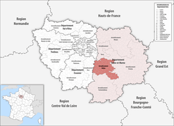 Location of Melun in Île-de-France | |
| Country | France |
| Region | Île-de-France |
| Department | Seine-et-Marne |
| Communes | 59 |
| Prefecture | Melun |
| Area¹ | |
| • Total | 614.4 km2 (237.2 sq mi) |
| Population (2013) | |
| • Total | 352,926 |
| • Density | 570/km2 (1,500/sq mi) |
| ¹ French Land Register data, which exclude lakes, ponds, and glaciers larger than 1 km² as well as the estuaries of rivers. | |
The arrondissement of Melun is an arrondissement of France in the Seine-et-Marne department in the Île-de-France region. In 1993 it lost the two cantons of Roissy-en-Brie and Pontault-Combault to the new arrondissement of Noisiel (since 1994 Torcy).[1] In 2006 it lost the canton of Rozay-en-Brie to the arrondissement of Provins.[2] Since the January 2017 reorganization of the arrondissements of Seine-et-Marne, it has 59 communes.[3]
Composition
Cantons
The cantons of the arrondissement of Melun are:
- Combs-la-Ville (partly)
- Fontainebleau (partly)
- Fontenay-Trésigny (partly)
- Melun
- Nangis (partly)
- Saint-Fargeau-Ponthierry
- Savigny-le-Temple
Communes
The communes of the arrondissement of Melun, and their INSEE codes, are:
- Andrezel (77004)
- Argentières (77007)
- Beauvoir (77029)
- Blandy (77034)
- Boissettes (77038)
- Boissise-la-Bertrand (77039)
- Boissise-le-Roi (77040)
- Bombon (77044)
- Cesson (77067)
- Champdeuil (77081)
- Champeaux (77082)
- Le Châtelet-en-Brie (77100)
- Châtillon-la-Borde (77103)
- Chaumes-en-Brie (77107)
- Combs-la-Ville (77122)
- Coubert (77127)
- Courquetaine (77136)
- Crisenoy (77145)
- Dammarie-les-Lys (77152)
- Échouboulains (77164)
- Les Écrennes (77165)
- Évry-Grégy-sur-Yerre (77175)
- Féricy (77179)
- Fontaine-le-Port (77188)
- Fouju (77195)
- Grisy-Suisnes (77217)
- Guignes (77222)
- Lieusaint (77251)
- Limoges-Fourches (77252)
- Lissy (77253)
- Livry-sur-Seine (77255)
- Machault (77266)
- Maincy (77269)
- Le Mée-sur-Seine (77285)
- Melun (77288)
- Moisenay (77295)
- Moissy-Cramayel (77296)
- Montereau-sur-le-Jard (77306)
- Nandy (77326)
- Ozouer-le-Voulgis (77352)
- Pamfou (77354)
- Pringy (77378)
- Réau (77384)
- La Rochette (77389)
- Rubelles (77394)
- Saint-Fargeau-Ponthierry (77407)
- Saint-Germain-Laxis (77410)
- Saint-Méry (77426)
- Savigny-le-Temple (77445)
- Seine-Port (77447)
- Sivry-Courtry (77453)
- Soignolles-en-Brie (77455)
- Solers (77457)
- Valence-en-Brie (77480)
- Vaux-le-Pénil (77487)
- Vert-Saint-Denis (77495)
- Villiers-en-Bière (77518)
- Voisenon (77528)
- Yèbles (77534)
References
External links
This article is issued from
Wikipedia.
The text is licensed under Creative Commons - Attribution - Sharealike.
Additional terms may apply for the media files.