Arrondissement of Ambert
| Ambert | |
|---|---|
| Arrondissement | |
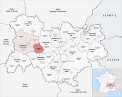 Location of the arrondissement in Auvergne-Rhône-Alpes | |
| Country | France |
| Region | Auvergne-Rhône-Alpes |
| Department | Puy-de-Dôme |
| Communes | 58 |
| Subprefecture | Ambert |
| Area¹ | |
| • Total | 1,230 km2 (470 sq mi) |
| Population (2013) | |
| • Total | 26,742 |
| • Density | 22/km2 (56/sq mi) |
| ¹ French Land Register data, which exclude lakes, ponds, and glaciers larger than 1 km² as well as the estuaries of rivers. | |
The arrondissement of Ambert is an arrondissement of France in the Puy-de-Dôme department in the Auvergne-Rhône-Alpes region. Since the January 2017 reorganization of the arrondissements of Puy-de-Dôme, it has 58 communes.[1]
Composition
Cantons
The cantons of the arrondissement of Ambert are:
- Ambert
- Les Monts du Livradois (partly)
Communes
The communes of the arrondissement of Ambert, and their INSEE codes, are:
- Aix-la-Fayette (63002)
- Ambert (63003)
- Arlanc (63010)
- Auzelles (63023)
- Baffie (63027)
- Bertignat (63037)
- Beurières (63039)
- Brousse (63056)
- Le Brugeron (63057)
- Ceilloux (63065)
- Chambon-sur-Dolore (63076)
- Champétières (63081)
- La Chapelle-Agnon (63086)
- La Chaulme (63104)
- Chaumont-le-Bourg (63105)
- Condat-lès-Montboissier (63119)
- Cunlhat (63132)
- Domaize (63136)
- Doranges (63137)
- Dore-l'Église (63139)
- Échandelys (63142)
- Églisolles (63147)
- Fayet-Ronaye (63158)
- La Forie (63161)
- Fournols (63162)
- Grandrif (63173)
- Grandval (63174)
- Job (63179)
- Marat (63207)
- Marsac-en-Livradois (63211)
- Mayres (63218)
- Medeyrolles (63221)
- Le Monestier (63230)
- Novacelles (63256)
- Olliergues (63258)
- Saillant (63309)
- Saint-Alyre-d'Arlanc (63312)
- Saint-Amant-Roche-Savine (63314)
- Saint-Anthème (63319)
- Saint-Bonnet-le-Bourg (63323)
- Saint-Bonnet-le-Chastel (63324)
- Saint-Clément-de-Valorgue (63331)
- Sainte-Catherine (63328)
- Saint-Éloy-la-Glacière (63337)
- Saint-Ferréol-des-Côtes (63341)
- Saint-Germain-l'Herm (63353)
- Saint-Gervais-sous-Meymont (63355)
- Saint-Just (63371)
- Saint-Martin-des-Olmes (63374)
- Saint-Pierre-la-Bourlhonne (63384)
- Saint-Romain (63394)
- Saint-Sauveur-la-Sagne (63398)
- Sauvessanges (63412)
- Thiolières (63431)
- Tours-sur-Meymont (63434)
- Valcivières (63441)
- Vertolaye (63454)
- Viverols (63465)
References
- ↑ "Arrêté n° 16-536, p 742" (PDF). Retrieved 2017-07-27.
External links
This article is issued from
Wikipedia.
The text is licensed under Creative Commons - Attribution - Sharealike.
Additional terms may apply for the media files.