Arimalam
| Arimalam அரிமழம் | |
|---|---|
| Town | |
 Arimalam Location in Tamil Nadu, India | |
| Coordinates: 10°15′27″N 78°53′22″E / 10.257434°N 78.889371°ECoordinates: 10°15′27″N 78°53′22″E / 10.257434°N 78.889371°E | |
| Country |
|
| State | Tamil Nadu |
| District | Pudukkottai |
| Elevation | 66 m (217 ft) |
| Population (2001) | |
| • Total | 7,811 |
| Languages | |
| • Official | Tamil, English |
| Time zone | UTC+5:30 (IST) |
| PIN | 622201 |
| Telephone code | 04333 |
| Vehicle registration | TN 55 |
| Website | www.arimalam.in |
Arimalam is a Town Panchayath in the district of Pudukkottai, in the state of Tamil Nadu, India.
Geography
Arimalam is located at 10°15′27″N 78°53′22″E / 10.257434°N 78.889371°E. It has an average elevation of 66 metres (216 feet). It is 22 kilometers away from Pudukkottai and is well connected by public transport.
Rulers
Arimalam is part of an area that saw rulers from the Chola dynasty, Pandyan dynasty, and the Thondaiman dynasty. It became part of the princely state of Pudukkottai under British rule.
Demographics
As of the 2011 Indian census, The Arimalam city is divided into 15 wards for which elections are held every 5 years. The Arimalam Town Panchayat has population of 19,948 of which 10,552 are males while 9,448 are females as per report released by Census India 2015.
Population of Children with age of 0-6 is 890 which is 9.95% of total population of Arimalam (TP). In Arimalam Town Panchayat, Female Sex Ratio is of 1004 against state average of 996. Moreover Child Sex Ratio in Arimalam is around 1055 compared to Tamil Nadu state average of 943.
Literacy rate of Arimalam city is 78.98% lower than state average of 80.09%. In Arimalam, Male literacy is around 87.25% while female literacy rate is 70.69%.
Arimalam Town Panchayat has total administration over 2,184 houses to which it supplies basic amenities like water and sewerage. It is also authorized to build roads within Town Panchayat limits and impose taxes on properties coming under its jurisdiction.
Locations
There many temples located in and around Arimalam which has high religious importance.
Famous Temples in Arimalam are:
- Meenaskshi Sundarswarer Kovil (Sivan Kovil), which is owned by Arimalam Nagarathar's was built at a cost of Rupees 5,00,000 in the year 1780. The subsequent Kumbabishekam for the temple was carried out on the following years 1903, 1944, 1958, 1975, 1991, 2005.
- Sri Soundararaja Perumal Kovil, which is managed by P.S.S.M and P.S.S.Kt Family is more than 100 years old. ☆Manikka Vinayagar Thirukovil
- Jaya Vilangiamman Kovil
- Sri sirameetar Kali Amman & sirameetar ayyanar koil
- Subramaninar Kovil
- Sundara Swamigal Athishtanam Kovil
- Mariyamman Kovil
- Sreenivas Perumal Kovil
- Palladayar Kovil
- Saathappa Athishtanam Kovil
- Muni Kovil
- Sandhi Veeran Kovil
- Chella Ayyanar Kovil
- Sri Paripala Vinayagar Kovil
Other Temples near Arimalam are:
- Santhiveeran Kompalayam,
- Chellaiyanar Kovil,
- Chattiram Kamatchi Amman Kovil,
- Panaiyur Kamatchi Amman Kovil
- Onangudi Veerama Kaliamman Kovil
Arimalam Theppam is famous and it is very rarely conducted because of lack of water in the pond which is situated near Pokkadan. There are also many temples located around the town. St. Joseph's Church, Roman Catholic parish church, located in Pudur Agraharam and Adaikalamadha Church, Roman Catholic non-parish church, located in Sirayampatti, Arimalam-Kulavaipatti Road, Arimalam.
Schools
- Government Boys Higher Secondary School
- Government Girls Higher Secondary School
- Government Primary School
- Government Primary School, Meenakshipuram
- Government Primary School, Kamatchipuram
- Sri Sivaakamalam Matriculation Higher Secondary School (Tamil & English Medium)
- Mercury Primary School (English Medium)
- Sri Raja Victory School (English Medium)
References
External links
- Government School - Old Student Association FB Page
- Government School - Old Student Association Twitter Page
- Official website of Pudukkottai District
Sri Sivaakamalam Matriculation Higher Secondary School
| Towns | 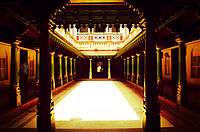 | |
|---|---|---|
| Villages |
| |
| Temples |
| |
| Notable Chettiars | ||
| Miscellaneous | ||