Ardmore, Alabama
| Ardmore, Alabama | |
|---|---|
| Town | |
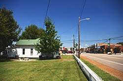 View along Ardmore Avenue (SR 53); Town Hall on the left | |
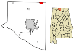 Location of Ardmore in Limestone County, Alabama. | |
| Coordinates: 34°59′13″N 86°50′35″W / 34.98694°N 86.84306°W | |
| Country | United States |
| State | Alabama |
| County | Limestone County, Alabama |
| Incorporation | 1922[1] |
| Government | |
| • Mayor | Billy Shannon |
| Area[2] | |
| • Total | 2.05 sq mi (5.31 km2) |
| • Land | 2.04 sq mi (5.29 km2) |
| • Water | 0.01 sq mi (0.02 km2) |
| Elevation | 883 ft (269 m) |
| Population (2010) | |
| • Total | 1,194 |
| • Estimate (2017)[3] | 1,398 |
| • Density | 684.62/sq mi (264.28/km2) |
| Time zone | UTC-6 (Central (CST)) |
| • Summer (DST) | UTC-5 (CDT) |
| ZIP code | 35739 |
| Area code(s) | 256 |
| FIPS code | 01-02260 |
| GNIS feature ID | 0113204 |
Ardmore is a town in Limestone County, Alabama, United States, and is included in the Huntsville-Decatur Metro Area. It is home to the Saturn IB rocket at the Alabama Welcome Center, just south of the Tennessee border, on Interstate 65.[4] As of the 2010 census, the population of the town is 1,194. It borders its sister city Ardmore, Tennessee.
History
The settlement was originally named Austin, after Alex Austin, who selected the location as a site for a station along the Louisville and Nashville Railroad. The railroad company later renamed the town Ardmore, for the community of Ardmore, Pennsylvania. Ardmore, Alabama was incorporated in 1922.[5]
Geography
Ardmore is located at 34°59′13″N 86°50′36″W / 34.98694°N 86.84333°W (34.987052, -86.843228).[6] It is the northernmost settlement in the state of Alabama.[7] The town is concentrated along Alabama State Route 53, which runs south to north along Ardmore Avenue before veering east along the state line, where it runs congruent with Tennessee State Route 7 on Main Street. Interstate 65, which connects Nashville and Birmingham, passes just west of Ardmore.
Main Street is the state line. The road heading northbound/westbound is in Tennessee, while southbound/eastbound is in Alabama.
According to the U.S. Census Bureau, the town has a total area of 2.0 square miles (5.2 km2), all land.
Demographics
| Historical population | |||
|---|---|---|---|
| Census | Pop. | %± | |
| 1930 | 266 | — | |
| 1940 | 381 | 43.2% | |
| 1950 | 408 | 7.1% | |
| 1960 | 439 | 7.6% | |
| 1970 | 761 | 73.3% | |
| 1980 | 1,096 | 44.0% | |
| 1990 | 1,090 | −0.5% | |
| 2000 | 1,034 | −5.1% | |
| 2010 | 1,194 | 15.5% | |
| Est. 2017 | 1,398 | [3] | 17.1% |
| U.S. Decennial Census[8] 2013 Estimate[9] | |||
2000 Census data
As of the census[10] of 2000, there were 1,034 people, 460 households, and 276 families residing in the town. The population density was 506.8 people per square mile (195.7/km2). There were 506 housing units at an average density of 248.0 per square mile (95.8/km2). The racial makeup of the town was 96.23% White, 0.87% Black or African American, 0.48% Native American, 0.77% Asian, 0.10% Pacific Islander, 1.16% from other races, and 0.39% from two or more races. 1.74% of the population were Hispanic or Latino of any race.
There were 460 households out of which 27.0% had children under the age of 18 living with them, 43.0% were married couples living together, 11.5% had a female householder with no husband present, and 39.8% were non-families. 36.5% of all households were made up of individuals, and 21.1% had someone living alone who was 65 years of age or older. The average household size was 2.25, and the average family size was 2.96.
In the town, the population was spread out with 25.0% under the age of 18, 8.3% from 18 to 24, 25.7% from 25 to 44, 24.6% from 45 to 64, and 16.4% who were 65 years of age or older. The median age was 37 years. For every 100 females, there were 81.4 males. For every 100 females age 18 and over, there were 78.0 males.
The median income for a household in the town was $28,352, and the median income for a family was $40,673. Males had a median income of $29,531 versus $19,875 for females. The per capita income for the town was $18,447. About 10.7% of families and 17.9% of the population were below the poverty line, including 20.2% of those under age 18 and 30.7% of those age 65 or over.
2010 census
As of the census[11] of 2010, there were 1,194 people, 505 households, and 333 families residing in the town. The population density was 517 people per square mile (195.1/km2). There were 578 housing units at an average density of 289 per square mile (109.1/km2). The racial makeup of the town was 94.3% White, 1.9% Black or African American, 0.8% Native American, 0.9% Asian, 0.1% Pacific Islander, .6% from other races, and 1.4% from two or more races. 1.3% of the population were Hispanic or Latino of any race.
There were 505 households out of which 28.1% had children under the age of 18 living with them, 44.8% were married couples living together, 15.4% had a female householder with no husband present, and 34.1% were non-families. 31.5% of all households were made up of individuals, and 18.5% had someone living alone who was 65 years of age or older. The average household size was 2.36, and the average family size was 2.97.
In the town, the population was spread out with 24.9% under the age of 18, 10.7% from 18 to 24, 25.7% from 25 to 44, 21.9% from 45 to 64, and 16.8% who were 65 years of age or older. The median age was 37.1 years. For every 100 females, there were 82.3 males. For every 100 females age 18 and over, there were 90.7 males.
The median income for a household in the town was $32,196, and the median income for a family was $36,779. Males had a median income of $31,600 versus $37,841 for females. The per capita income for the town was $18,931. About 13.0% of families and 18.8% of the population were below the poverty line, including 21.9% of those under age 18 and 19.2% of those age 65 or over.
In popular culture
Ardmore is the setting of a song by Old Crow Medicine Show called "Alabama High-Test," on the album Tennessee Pusher.[12]
Notable person
- David Fanning, country music singer, songwriter, and record producer
References
- ↑ Kaetz, James P., "Ardmore", Encyclopedia of Alabama, retrieved 2018-10-14
- ↑ "2017 U.S. Gazetteer Files". United States Census Bureau. Retrieved Jul 7, 2018.
- 1 2 "Population and Housing Unit Estimates". Retrieved March 24, 2018.
- ↑ Hughes, Bayne (April 6, 2014). "Iconic rocket due for repair". The Decatur Daily. Retrieved April 8, 2014.
- ↑ Foscue, Virginia. Place Names in Alabama. University: U of Alabama Press, 1989.
- ↑ "US Gazetteer files: 2010, 2000, and 1990". United States Census Bureau. 2011-02-12. Retrieved 2011-04-23.
- ↑ "EXTREME SETTLEMENTS: A COMPREHENSIVE LIST". Weekend Roady. 2013-05-02. Retrieved 2014-08-20.
- ↑ "U.S. Decennial Census". Census.gov. Archived from the original on May 12, 2015. Retrieved June 6, 2013.
- ↑ "Annual Estimates of the Resident Population: April 1, 2010 to July 1, 2013". Retrieved June 3, 2014.
- ↑ "American FactFinder". United States Census Bureau. Archived from the original on 2013-09-11. Retrieved 2008-01-31.
- ↑ "American FactFinder". United States Census Bureau. Archived from the original on 2013-09-11. Retrieved 2015-08-01.
- ↑ "Old Crow has the ideal medicine for a bad case of glitz: great music". Huntsville Times. 2009-09-17. Retrieved 2009-09-17.
External links

Coordinates: 34°59′13″N 86°50′36″W / 34.987052°N 86.843228°W
Municipalities and communities of Limestone County, Alabama, United States | ||
|---|---|---|
| Cities |  | |
| Towns | ||
| Unincorporated communities | ||
| Footnotes | ‡This populated place also has portions in an adjacent county or counties | |