Arbovale, West Virginia
| Arbovale, West Virginia | |
|---|---|
| Unincorporated community | |
 Arbovale, West Virginia  Arbovale, West Virginia | |
| Coordinates: 38°26′07″N 79°49′03″W / 38.43528°N 79.81750°WCoordinates: 38°26′07″N 79°49′03″W / 38.43528°N 79.81750°W | |
| Country | United States |
| State | West Virginia |
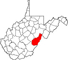
| County | Pocahontas |
| Elevation | 2,726 ft (831 m) |
| Time zone | UTC-5 (Eastern (EST)) |
| • Summer (DST) | UTC-4 (EDT) |
| ZIP code | 24915[1] |
| Area code(s) | 304 & 681 |
| GNIS feature ID | 1553737[2] |
Arbovale is an unincorporated community in Pocahontas County, West Virginia, United States. Arbovale is 12 miles (19 km) south of Durbin. Arbovale had a post office, which closed on March 3, 2007.[3]
Arbovale derives its name from Adam Arbogast, who settled in the vale where the town site is situated.[4]
Climate
The climate in this area has mild differences between highs and lows, and there is adequate rainfall year-round. According to the Köppen Climate Classification system, Arbovale has a marine west coast climate, abbreviated "Cfb" on climate maps.[5]
References
- ↑ United States Postal Service (2012). "USPS - Look Up a ZIP Code". Retrieved 2012-02-15.
- ↑ U.S. Geological Survey Geographic Names Information System: Arbovale, West Virginia
- ↑ "Postmaster Finder - Post Offices by ZIP Code". United States Postal Service. Retrieved September 26, 2011.
- ↑ Kenny, Hamill (1945). West Virginia Place Names: Their Origin and Meaning, Including the Nomenclature of the Streams and Mountains. Piedmont, WV: The Place Name Press. p. 83.
- ↑ Climate Summary for Arbovale, West Virginia
This article is issued from
Wikipedia.
The text is licensed under Creative Commons - Attribution - Sharealike.
Additional terms may apply for the media files.