Andersson Island
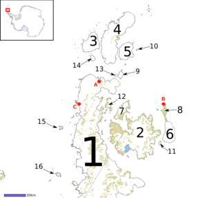 Andersson Island (labelled 9) amongst the island chain off the tip of the Antarctic Peninsula | |
 Andersson | |
| Geography | |
|---|---|
| Location | Antarctic Sound |
| Coordinates | 63°35′S 56°35′W / 63.583°S 56.583°WCoordinates: 63°35′S 56°35′W / 63.583°S 56.583°W |
| Archipelago | Joinville Island group |
| Adjacent bodies of water | Hope Bay |
| Length | 1.9 km (1.18 mi) |
| Highest elevation | 435 m (1,427 ft) |
| Administration | |
| Administered under the Antarctic Treaty System | |
Andersson Island (historically Rosamel Island) is an island located at the eastern end of the Tabarin Peninsula, Antarctica.
The island was first named by the French Antarctic Expedition in 1838, who called it le Rosamel in honor of Vice Admiral Claude Charles Marie du Campe de Rosamel, French Naval Minister. It was a way point on the second French exploration of the region. Jules Dumont d'Urville put anchor off the island when conditions aboard the Astrolabe and Zelee became overwhelming. The majority of the crew of the Astrolabe had obvious symptoms of scurvy and the main decks were covered by smoke from the ships' fires and bad smells and became unbearable.
The Swedish Antarctic Expedition (SwAE) in 1902 named it le de l'Uruguay, after the vessel Uruguay, which had rescued the SwAE party from Snow Hill Island.
It was ultimately renamed Andersson Island on November 21, 1949. It was named for Dr. Johan Gunnar Andersson (1874-1960), a Swedish geologist who had served on the SwAE. The renaming was necessary to avoid confusion with Uruguay Island, located off the Graham Coast.[1]
See also
References
![]()