Anand, Gujarat
| Anand The Milk City | |
|---|---|
| city | |
| Nickname(s): The Milk City | |
 Anand Location in Gujarat, India  Anand Anand (India) | |
| Coordinates: 22°33′22″N 72°57′04″E / 22.556°N 72.951°ECoordinates: 22°33′22″N 72°57′04″E / 22.556°N 72.951°E | |
| Country |
|
| State | Gujarat |
| District | Anand |
| Government | |
| • Type | IAS |
| Area | |
| • Total | 2,939.9 km2 (1,135.1 sq mi) |
| Elevation | 39 m (128 ft) |
| Population (2011) | |
| • Total | 420 |
| • Density | 711/km2 (1,840/sq mi) |
| Languages | |
| • Official | Gujarati, Hindi |
| Time zone | UTC+0:30 (IST) |
| PIN | 388001 |
| Area code(s) | 2692 |
| Vehicle registration | GJ 23 |
| Website |
gujaratindia |
Anand (![]()
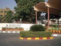
Anand is known as the Milk Capital of India. It became famous for Amul dairy and its milk revolution. This city hosts the Head Office of Gujarat Cooperative Milk Marketing Federation Ltd (GCMMF which is parent organisation for AMUL & co-operative operations to collect milk), NDDB of India, well known business school - Institute of Rural Management Anand (IRMA), Vidya Dairy and the Anand Agricultural University. Another famous educational hub is Vallabh Vidhyanagar, an educational suburb of Anand which is home for around 50,000 students from all over the India.
Anand lies between Ahmedabad and Vadodara on the Western Railways, 101 km from the state capital Gandhinagar. It is a railway Junction and a broad gauge line from here runs to Godhra, covering Dakor, a major Hindu pilgrimage en route. MEMUs and one or two regular passenger trains ply on this route. It also has a branch line to Khambhat. DMUs Diesel Multiple Units ply on this route as it is not electrified yet. Anand Railway Station has 5 platforms, numbers 1, 2, 3 and 4 are on the main line and number 5 is on the branch line to Godhra. A new platform is in construction on the branch to Ahmedabad from the Godhra line forming a triangle. The National express highway from Ahmedabad to Vadodara also passes through Anand.
Anand has seen rapid economic growth along the Anand-Vallabh Vidya Nagar and Karamsad road belt. It is well on track to become a Municipal Corporation with the inclusion of various peripheral villages like Karamsad, Chikhodra, Lambhvel, V. V Nagar, Bakrol, Mogri and 20 others, however the major part of the town still lacks drainage system.[1]
Geography
Anand is located at 22°34′N 72°56′E / 22.57°N 72.93°E.[2] It has an average elevation of 39 metres (127 feet). The city has an area of 22.7 square kilometres, and the urban area of Anand City is 172 square kilometres including 25 villages around the city.
Demographics
As of 2001 India census,[3] Anand had a population of 300,462. Males constitute 52% of the population and females 48%. Anand has an average literacy rate of 78%, higher than the national average of 59.5% (55% of the males and 45% of females literate). 11% of the population is under 6 years of age. Average literacy rate of Anand in 2011 were 84.37 compared to 74.51 of 2001. Gender wise, male and female literacy were 91.82 and 76.36 respectively. For 2001 census, same figures stood at 86.09 and 61.94 in Anand District.[4]
Economy
Economy of the Anand is very vibrant which ranges from farming to big scale industries. Major crops includes Tobacco and Banana. Anand is home to the famous Amul Dairy [5] and Vidya Dairy[6]. Vitthal Udhyog Nagar,a very big industrial belt is located on the outskirts of the city. Many famous industries including Elecon Engineering, Vulcan Industrial Engineering Co. Ltd, Warm Steam, The Charotar Iron Factory(est.1938), Milcent and Atlanta Electrics are situated in this industrial belt .Also there are three vegetable markets which have developed in this city.
Notable people
- Vallabhbhai Patel, First Deputy Prime Minister of India
- Verghese Kurien, the man who made the milk revolution possible
- Axar Patel, Indian limited overs cricketer
References
| Wikivoyage has a travel guide for Anand. |
| Wikimedia Commons has media related to Anand, Gujarat. |
- ↑ http://www.gwssb.gujarat.gov.in/urban-drainage
- ↑ Falling Rain Genomics, Inc - Anand
- ↑ "Census of India 2001: Data from the 2001 Census, including cities, villages and towns (Provisional)". Census Commission of India. Archived from the original on 2004-06-16. Retrieved 2008-11-01.
- ↑ "Census of India 2001: Data from the 2001 Census, including cities, villages and towns (Provisional)". Census Commission of India. Archived from the original on 2004-06-16. Retrieved 2008-11-01. http://www.census2011.co.in/census/district/196-anand.html
- ↑ www.amul.com
- ↑ www.vidyadairy.in