Anakiwa, New Zealand
| Anakiwa | |
|---|---|
 Anakiwa from the south-west, looking toward Outward Bound | |
 Anakiwa | |
| Coordinates: 41°15′52″S 173°54′46″E / 41.26444°S 173.91278°E | |
| Country | New Zealand |
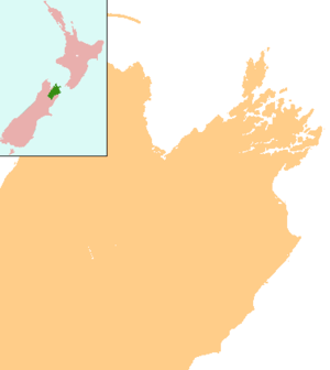
| Region | Marlborough |
Anakiwa is a coastal residential village in the Marlborough region of New Zealand. It sits at the head of Queen Charlotte Sound/Tōtaranui, one of the Marlborough Sounds. 2013 census data suggests a population of 177,[1] however a high proportion of dwellings are only seasonally occupied.
Anakiwa is also the terminus of the Queen Charlotte Track, with most hikers choosing to complete their walk here, before catching a water taxi back to Picton.[2]
Services
Anakiwa has two public wharves, each with a public boat ramp. There are a total of 5 publicly accessible boat ramps along the Anakiwa foreshore. There are numerous lodges, backpacker, and bed & breakfast accommodation within the village, as well as a seasonal store which caters to Queen Charlotte track hikers, as well as other visitors. Public toilets are located metres from the entrance to the Queen Charlotte track, along with a payphone in a small kiosk shelter.
Other nearby services, within a 7 km radius, in the Linkwater valley include a Challenge Petrol station & store; camping ground with cabins; motel; primary school; community hall; and a rural fire station. Havelock is the nearest town, being 20 kilometres west with a 25-minute drive. Picton is 22 kilometres east, accessible by road for 35 minutes. The major centre of Blenheim is 59 kilometres south, a 56-minute drive, and is where the main airport is which serves the region.
History
Anakiwa had long been a Māori settlement, most recently occupied by members of the Ngāti Rāhiri hapū of Te Ātiawa iwi[3] until 1859 when they returned to Taranaki, at least in part to fight in the First Taranaki War.[4] In earlier centuries, the Ngai Tara iwi had influence over the area. It was included in the New Zealand Company's deed of purchase in 1839, though there is doubt that the chiefs of the region understood the document or that it was correctly translated.[5]
In 1864, the New Zealand Government granted land to the Beauchamp family for farming in Anakiwa. In 1928 the family built a guesthouse on the site, which was purchased with donated funds by Hamish Thomas as the site for Outward Bound New Zealand.[6] It was opened as "The Cobham Outward Bound School" in 1962 by Governor-General Lord Cobham.[7]
Tirimoana is a settlement within Anakiwa which was originally known as the Tirimoana Subdivision of the farm lands that once occupied the area to the south and west of Outward Bound School.
Boundary Gate Corner which is 3.25 kilometres from the Queen Charlotte Drive intersection, marked the boundary between the two farms in the early 1900s, and a gate once stood here across the access road. Today, there is a sign and bench seat which marks this location.
References
- ↑ "2013 Census map". Retrieved 30 May 2018.
- ↑ "Anakiwa". Cruise Guide to the Marlborough Sounds. Retrieved 30 May 2018.
- ↑ "Palisades and kumara". Department of Conservation. New Zealand Government. Retrieved 30 May 2018.
- ↑ Mitchell, Hilary; Mitchell, John (2007). Te Tau Ihu o te Waka: History of Māori of Nelson and Marlborough. 2. Wellington: Huia Publishers. pp. 392–3. ISBN 9781869692940.
- ↑ Mitchell, Hilary; Mitchell, John (2004). Te Tau Ihu o te Waka: History of Māori of Nelson and Marlborough. 1. Wellington: Huia Publishers. pp. 76–7, 274–81. ISBN 9781869690878.
- ↑ "Adventures for body and soul". The Press. 24 November 2012. Retrieved 28 May 2018.
- ↑ Inside Outward Bound, The New Zealand Journey (Motion picture). Outward Bound Trust New Zealand. 2014. Retrieved 27 May 2018.
Coordinates: 41°15′52″S 173°54′46″E / 41.26444°S 173.91278°E