Nong Ya Sai District
| Nong Ya Sai หนองหญ้าไซ | |
|---|---|
| District | |
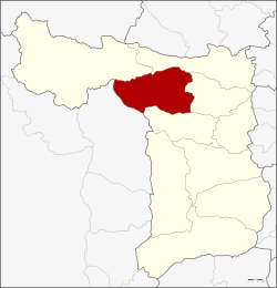 District location in Suphan Buri Province | |
| Coordinates: 14°46′30″N 99°54′40″E / 14.77500°N 99.91111°ECoordinates: 14°46′30″N 99°54′40″E / 14.77500°N 99.91111°E | |
| Country | Thailand |
| Province | Suphan Buri |
| Seat | Nong Ya Sai |
| Area | |
| • Total | 420.2 km2 (162.2 sq mi) |
| Population (2013) | |
| • Total | 49,272 |
| • Density | 118.7/km2 (307/sq mi) |
| Time zone | UTC+7 (ICT) |
| Postal code | 72240 |
| Geocode | 7210 |
Nong Ya Sai (Thai: หนองหญ้าไซ, pronounced [nɔ̌ːŋ jâː sāj]) is a district (amphoe) in the western part of Suphan Buri Province, central Thailand.
History
The minor district (king amphoe) was created on 1 June 1983, when the four tambons Nong Ya Sai, Nong Rathawat, Nong Pho, and Chaeng Ngam were split off from Sam Chuk District.[1] It was upgraded to a full district on 21 May 1990.[2]
Geography
Neighboring districts are (from the north clockwise) Dan Chang, Doem Bang Nang Buat, Sam Chuk, and Don Chedi of Suphan Buri Province, and Lao Khwan of Kanchanaburi Province
Administration
Central administration
Nong Ya Sai is divided into six sub-districts (tambons), which are further subdivided into 66 administrative villages (mubans).
| No. | Name | Thai | Villages | Pop.[3] |
|---|---|---|---|---|
| 1. | Nong Ya Sai | หนองหญ้าไซ | 13 | 11,985 |
| 2. | Nong Ratchawat | หนองราชวัตร | 8 | 5,120 |
| 3. | Nong Pho | หนองโพธิ์ | 14 | 6,748 |
| 4. | Chaeng Ngam | แจงงาม | 8 | 6,473 |
| 5. | Nong Kham | หนองขาม | 11 | 8,981 |
| 6. | Thap Luang | ทัพหลวง | 12 | 9,965 |
Local administration
There is one sub-district municipality (thesaban tambon) in the district:
- Nong Ya Sai (Thai: เทศบาลตำบลหนองหญ้าไซ) consisting of parts of sub-district Nong Ya Sai.
There are six sub-district administrative organizations (SAO) in the district:
- Nong Ya Sai (Thai: องค์การบริหารส่วนตำบลหนองหญ้าไซ) consisting of parts of sub-district Nong Ya Sai.
- Nong Ratchawat (Thai: องค์การบริหารส่วนตำบลหนองราชวัตร) consisting of sub-district Nong Ratchawat.
- Nong Pho (Thai: องค์การบริหารส่วนตำบลหนองโพธิ์) consisting of sub-district Nong Pho.
- Chaeng Ngam (Thai: องค์การบริหารส่วนตำบลแจงงาม) consisting of sub-district Chaeng Ngam.
- Nong Kham (Thai: องค์การบริหารส่วนตำบลหนองขาม) consisting of sub-district Nong Kham.
- Thap Luang (Thai: องค์การบริหารส่วนตำบลทัพหลวง) consisting of sub-district Thap Luang.
References
- ↑ ประกาศกระทรวงมหาดไทย เรื่อง แบ่งท้องที่อำเภอสามชุก จังหวัดสุพรรณบุรี ตั้งเป็นกิ่งอำเภอหนองหญ้าไซ (PDF). Royal Gazette (in Thai). 100 (92 ง): 1836. June 7, 1983.
- ↑ พระราชกฤษฎีกาตั้งอำเภอห้วยผึ้ง อำเภอวังวิเศษ อำเภอคลองหาด อำเภอป่าบอน อำเภอหนองหญ้าปล้อง อำเภอวังโป่ง อำเภอควนเนียง อำเภอหนองหญ้าไซ อำเภอบ้านนาเดิม อำเภอทุ่งฝน อำเภอสร้างคอม และอำเภอทองแสนขัน พ.ศ. ๒๕๓๓ (PDF). Royal Gazette (in Thai). 107 (83 ก special): 1–4. May 21, 1990.
- ↑ "Population statistics 2013" (in Thai). Department of Provincial Administration. Retrieved 2014-10-04.
External links