Hang Chat District
| Hang Chat ห้างฉัตร | |
|---|---|
| Amphoe | |
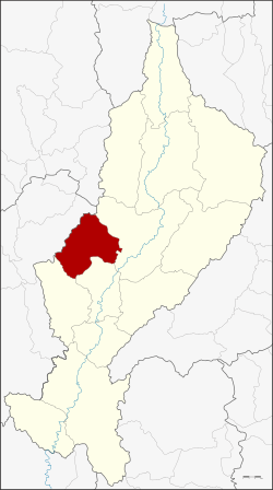 Amphoe location in Lampang Province | |
| Coordinates: 18°19′19″N 99°19′4″E / 18.32194°N 99.31778°ECoordinates: 18°19′19″N 99°19′4″E / 18.32194°N 99.31778°E | |
| Country | Thailand |
| Province | Lampang |
| Seat | Wiang Tan |
| Area | |
| • Total | 684.757 km2 (264.386 sq mi) |
| Population (2005) | |
| • Total | 51,495 |
| • Density | 75.2/km2 (195/sq mi) |
| Time zone | UTC+7 (ICT) |
| Postal code | 52190 |
| Geocode | 5212 |
Hang Chat (Thai: ห้างฉัตร, pronounced [hâːŋ t͡ɕʰàt]) is a district (amphoe) in the western part of Lampang Province, northern Thailand.
Geography
Neighboring districts are (from the northeast clockwise): Mueang Lampang, Ko Kha, Soem Ngam of Lampang Province and Mae Tha of Lamphun Province. The Khun Tan Range stretches from north to south along the district.
History
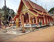
Wat Pong Yang Kok
Originally named Hang Sat (หางสัตว์, "animal tail"), it was renamed Hang Chat (ห้างฉัตร, "arch under royal umbrella") in 1940.[1]
Administration
The district is divided into seven sub-districts (tambon), which are further subdivided into 73 villages (muban). Hang Chat is a township (thesaban tambon) which covers parts of tambon Hang Chat. There are a further seven tambon administrative organizations (TAO).
| No. | Name | Thai name | Villages | Pop. | |
|---|---|---|---|---|---|
| 1. | Hang Chat | ห้างฉัตร | 9 | 10,216 | |
| 2. | Nong Lom | หนองหล่ม | 9 | 5,266 | |
| 3. | Mueang Yao | เมืองยาว | 15 | 8,267 | |
| 4. | Pong Yang Khok | ปงยางคก | 13 | 9,821 | |
| 5. | Wiang Tan | เวียงตาล | 11 | 8,778 | |
| 6. | Mae San | แม่สัน | 9 | 4,729 | |
| 7. | Wo Kaeo | วอแก้ว | 7 | 4,418 |
See also
References
- ↑ พระราชกฤษฎีกาเปลี่ยนนามอำเภอ กิ่งอำเภอ และตำบลบางแห่ง พุทธศักราช ๒๔๘๓ (PDF). Royal Gazette (in Thai). 57 (0 ก): 53–55. April 30, 1940.
External links
This article is issued from
Wikipedia.
The text is licensed under Creative Commons - Attribution - Sharealike.
Additional terms may apply for the media files.