Amorha
| Amorha Khas अमोढ़ा ख़ास | |
|---|---|
| Town (Pargana) | |
 Amorha Khas Location in Uttar Pradesh, India  Amorha Khas Amorha Khas (India) | |
| Coordinates: 26°46′05″N 82°23′29″E / 26.767975°N 82.391452°ECoordinates: 26°46′05″N 82°23′29″E / 26.767975°N 82.391452°E | |
| Country |
|
| State | Uttar Pradesh |
| District | Basti |
| Tehsil | Harraiya |
| Block | Vikram Jot |
| Population (2011) | |
| • Total | 5,977 |
| Languages | |
| • Official | Hindi |
| Time zone | UTC+5:30 (IST) |
| PIN | 272127 |
| Telephone code | 05546 |
.jpg)
Amorha Khas (Hindi: अमोढ़ा ख़ास) is a gram panchayat in Basti district in the Indian state of Uttar Pradesh. In the freedom struggle of 1857, about 250 martyrs of Amorha State were hanged by the British Government from peepal trees located at Chhawani.[1] [2]
Geography
Amorha Khas is located at 26°46′05″N 82°23′29″E / 26.767975°N 82.391452°E.[3]
.jpg)
Demographics
As of 2011 India census,[4] Amorha Khas is a large village located in Harraiya of Basti district, Uttar Pradesh with a total of 1009 families residing there. The Amorha Khas village has population of 5977 of which 2933 are males while 3044 are females as per Population Census 2011.[5] [6]
Famous places
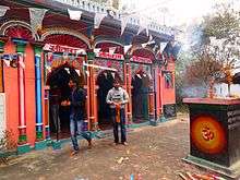
- Amorha Khas is situated at a distance of 41 km from the district headquarters. Its old name is Amorha, and it was once a province (state) of Raja Zalim Singh. Also Raja Zalim Singh's Mahal is here, Old wall of mahal is still there with the mark of a bullet used by the English. Also a famous temple Ramrekha Mandir is here. Ramrekha Temple is one of the most ancient Hindu Mandir of Lord Ram & Goddess Sita. Lord Shri Ram stayed here for one day during his journey of Janakpur-Ayodhya. Lord Shri Rama & Sita with Lakshmana journeyed towards Ayodhya by the road called Ram Janki Marg (State Highway 72) near Chhawani.[7][8][9]
- Chhawani is a Police Station and is situated at a distance of 40 km from the district headquarters. It was the main shelter for Indian fighters during the 1857 mutiny, and is noted for a Pipal Trees where about 250 martyrs were hanged by the British Government in action after the murder of General Fort.[1]
- Vikram Jot is a Block and small market of the Basti district 46 km away from the headquarters of Basti district. The last police station of Basti is there. The Ghaghara River adjoins the market. It is also a block of district and has an electric power station, a hospital with 50 beds, an animal hospital, two inter colleges (Shri Valmiki Inter College mainly), a ganna sumit, a post office and a police station near from village Chhatouna.
- Harraiya is one of the tehsils in Basti district. And there is an Epic story about its name that Lord Ram with Sita And Lakshman traveled this way in the Ramayan era.So it was then called as Harirahiya in Awadhi which later turned into Harraiya.It is also a legislative assembly
- Ramrekha Mandir is one of the most ancient Hindu Mandir of Lord Ram & Goddess Sita.[10]
- Makhauda Dham is one of the most ancient place where Raja Dashrath performed yajna with the help of Sage Rishyasringa on the advice of Vashistha.[11][12][13]
Villages
Amorha Khas, Akla, Akwara, Atraura Jham, Aurangabad, Babhan Ganwa, Babhrauli, Bachhipur, Basthanwa, Batauli, Beerpur Kharhara, Chandra Paliya, Chapilan, Chhitauna, Daharha Misra, Deokhal, Deokher, Devkali Rani, Dhaurahra Chauhan, Dhirauli Babu, Dhirauli Pandey, Dubhra Nirwahan, Gauriya Nain, Gunda Kunvar, Harewa Shukul, Imiliya, Jaitapur, Kalani Kala, Karamiya, Kenauna, Keshawapur, Kewalpur, Khan Kala - Chhawani, Khatan Sarai, Khemraj Pur, Khesua, Khesua, Kunwagaon, Lajghata, Madna Majha, Majhakita Avval, Majhil Gaon, Malaheni, Malauli Dubay, Malauli Gosain, Medhayan Shukul, Medhayen, Nagra Badli, Natauwa, Niyamatpur, Pachvas, Phooldih, Pipari Sangram, Pure Divaan, Pure Hemraj, Rani Gaon, Rikhipur, Rupgarh, Sauri, Savera Lala, Shankarpur, Sherwadeeh, Sitkaaha Panday, Sita Rampur, Sonbarsa, Sukrauli Pande, Tala Gaon, Tursi, Vikramjot.
Gallery
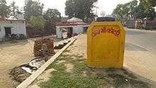
.jpg) Sansad Aadarsh Gram Amorha Khas (अमोढ़ा ख़ास)
Sansad Aadarsh Gram Amorha Khas (अमोढ़ा ख़ास).jpg) Lohia Samagra Gram Amorha Khas (अमोढ़ा ख़ास)
Lohia Samagra Gram Amorha Khas (अमोढ़ा ख़ास).jpg) Raja Zalim Singh Smarak Sthal, Amorha Khas, Basti, Uttar Pradesh (राजा ज़ालिम सिंह स्मारक स्थल, अमोढ़ा ख़ास, बस्ती उ0प्र0)
Raja Zalim Singh Smarak Sthal, Amorha Khas, Basti, Uttar Pradesh (राजा ज़ालिम सिंह स्मारक स्थल, अमोढ़ा ख़ास, बस्ती उ0प्र0)
References
- 1 2 "Places of Interest". basti.nic.in. Retrieved 9 June 2016.
- ↑ "AMODHA KHAS-Gram Panchayat - National Panchayat Portal - Govt. of India". panchayatportals.gov.in. Retrieved 2017-01-14.
- ↑ "Google maps location of Amorha". Google maps. Retrieved 2013-04-01.
- ↑ "Census of India 2001: Data from the 2001 Census, including cities, villages and towns (Provisional)". Census Commission of India. Archived from the original on 2004-06-16. Retrieved 2008-11-01.
- ↑ http://basti.nic.in/
- ↑ http://www.panchayatgyan.gov.in/documents/30336/0/1+sagy+ppr+vol-I.pdf/b5096716-05c1-4ae0-8783-4b4fdc720ac1
- ↑ Thomas, D. (1998). Battles and Honours of the Royal Navy. Leo Cooper. p. 16. ISBN 9780850526233. Retrieved 2017-01-14.
- ↑ Benett, W.C. (1878). The final settlement report on the Gonda district. 23. p. 22. Retrieved 2017-01-14.
- ↑ Michael, B.A. (2014). Statemaking and Territory in South Asia: Lessons from the Anglo–Gorkha War (1814–1816). Anthem Press. p. 151. ISBN 9781783083220. Retrieved 2017-01-14.
- ↑ http://www.jagran.com/uttar-pradesh/basti-12226638.html
- ↑ http://www.patrika.com/news/faizabad/saints-team-leaves-ayodhya-for-84-kosi-circuit-in-makhauda-dham-1277418/
- ↑ http://www.jagran.com/uttar-pradesh/basti-13212125.html
- ↑ http://www.amarujala.com/uttar-pradesh/basti/the-growth-of-mythological-sites