Ames Range
| Ames Range | |
|---|---|
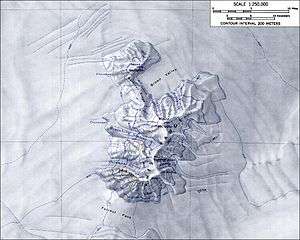 Map of the Ames Range | |
| Highest point | |
| Peak | Mount Andrus |
| Elevation | 2,978 m (9,770 ft) |
| Coordinates | 75°42′S 132°20′W / 75.700°S 132.333°W |
| Geography | |
| Continent | Antarctica |
| State/Province | Marie Byrd Land |
The Ames Range is an Antarctic range of snow-covered, flat-topped, steep-sided mountains, extending in a N-S direction for 32 km (20 mi) and forming a right angle with the eastern end of the Flood Range in Marie Byrd Land.
They were discovered by the United States Antarctic Service Expedition (1939–41) and named by Richard E. Byrd for his father-in-law, Joseph Ames.
The Ames Range consists of three coalescing shield volcanoes: Mount Andrus, Mount Kosciusko and Mount Kauffman, and Mount Boennighausen.[1]
Other Features
There are several glaciers draining from the Ames Range:
Other features include:
- Brown Valley
- Gardiner Ridge
- Forrest Pass, which separates the Ames Range from the Flood Range
Sources
Notes
This article is issued from
Wikipedia.
The text is licensed under Creative Commons - Attribution - Sharealike.
Additional terms may apply for the media files.