Amboori
| Amboori | |
|---|---|
| town | |
 Amboori Location in Kerala, India  Amboori Amboori (India) | |
| Coordinates: 8°28′N 77°11′E / 8.47°N 77.19°ECoordinates: 8°28′N 77°11′E / 8.47°N 77.19°E | |
| Country |
|
| State | Kerala |
| District | Thiruvananthapuram |
| Talukas | Neyyattinkara |
| Area | |
| • Total | 47.5893 km2 (18.3743 sq mi) |
| Population (2011) | |
| • Total | 9,249 |
| • Density | 190/km2 (500/sq mi) |
| Languages | |
| • Official | Malayalam, English |
| Time zone | UTC+5:30 (IST) |
| PIN | 695505 |
| Telephone code | 35567443 |
| Sex ratio | 1072 ♂/1000♀ |
Amboori is a village in the south east of Thiruvananthapuram district in the state of Kerala in India.[1]
The Amboori village has population of 9249 of which 4464 are males while 4785 are females as per Population Census 2011. The population of children aged 0-6 is 866, which makes up 9.36% of the total population of the village. The average sex ratio of Amboori village is 1072, lower than the Kerala state average of 1084. The child sex ratio for Amboori as per census is 977, higher than the Kerala average of 964.
Amboori village has a lower literacy rate than Kerala. In 2011, the literacy rate of Amboori village was 92.37% compared to 94.00% in Kerala. In Amboori male literacy stands at 94.34% while female literacy rate was 90.54%.
An important ethnic group in the area is the Kanikar tribe; about 1200 members of this tribe live in the area.
Amboori is 40 km (25 mi) from the Agastiya mountain peak where Sage Agastiya, the founder of Ayurveda, is believed to have built his hermitage.
Geography
Amboori is situated in the southern tip of western ghats, surrounded by hills and is near to kattakkada. South east of Amboori is the state of Tamil Nadu. It is surrounded by the grama panchayaths of Vellarada, Aryancode and Kallikkadu in the south, south-west and west respectively. The eastern part is covered by densely forested Neyyar Wildlife Sanctuary. Amboori is well known for its high-yielding rubber plantations, however, the area also cultivates coconut, pepper, herbs, and medicinal plants. Amboori contains a plantation of holy Rudraksha (Eleocarpus Spaericus) trees. Adjoining Amboori is the Neyyar Wildlife Sanctuary that is separated from the populated area by the catchment area of Neyyar Reservoir.
In the western hills of Amboori there is a large boulder called the Dravyappara (the treasure rock). It is believed that Raja of Venad, later Thiruvithamcore or Travancore, on his exile, spent his days on the top of this rock. There are 72 steps carved on the side of the boulder allowing one to ascend to the top. The height of the Dravyappara is approximately 700 ft from its base and approximately 1500 ft above sea level. There is cave temple in the top of Dravayappara.
Amboori has witnessed a large landslide in 2001 which claimed the life of 39 people.[2] The tragedy occurred when a hill collapsed on to a house where there was a family gathering.
History
Amboori was inhabited by members of the Kanikar tribe since time immemorial. After the Second World War, the princely state of Travancore experienced severe famine, so the Raja of Travancore allowed Saint Thomas Christians of Kottayam region such as Pala and Meenachil to settle in uncultivated Western Ghats ranges. That resulted large scale migration to tribal areas and alineation of tribal land.(history has it that marthandavarma maharaja has given 48000 hectors of land to kanikkars in chembu pattayam, totally exempting from land tax, this area mostly falls under neyyatinkara and nedumangadu taluks, amboori too falls under that stretch of land.) An early settlement of Christians was in Pantha, located north of Amboori, near Mayam. The St. Mary's Church of Mayam was the first Roman Catholic church in the area. St.Mary's School, Mayam was the first primary School in the area. Later during the construction of Neyyar Reservoir, the people of Pantha, mostly Syrian Christians, Pulayas and Parayas were forced to resettle. Most of them resettled in Amboori. In 1947 twenty-five families of the Central Travencore Syrian Christians made their way into the hills of what was to be called Amboori. The people found their way to the hill on which Amboory resides by carrying their possessions almost 12 km beyond Panachamoodu, the last point then served by public transportation.
The first three years was rife with hardship for Amboorians as they fought malaria and wild animals. Many lost their lives but could not be cared for or buried properly. In 1950 another fifty more families from Palai, Kanjirapally, Changanachery, Thodupuzha, and Chengannorr ventured to Amboory to make their homes there.
Educational institutions
- St. Thomas Higher Secondary School, both English and Malayalam medium
- St. Joseph's primary school
- St. Mary's Upper Primary School, Mayam
- Tribal Primary School, Puravimalai
- Kovilloor LPS Kannannoor, one of the first LP schools in Amboory area
- Govt. LP School, Kuttamala
- Mar Baselieus English Medium School, Kuttamala
- St. Mary's LP School, Thekkupara, S.H. Nursery school Thekkuppara
- Industrial Training Centre for Scheduled Tribes, Kuttamala
- Koottappu Gopalan Memorial Library and Research Institute, Koottappu
Legends
Legend has it that the poor citizens of Amboory used to get small loans from an unnamed goddess (spirit) of the Dravyappara. A request for money was to be said aloud standing next to a large granite door on the northeastern side of the rock. On approval of the loan by the devata, a granite bucket on the southeastern side of the door would be filled with the requested amount. The citizen was expected to remit the same amount in a reasonable time frame by dropping the money in the bucket and pronouncing aloud that the money was deposited.
It was an unspoken rule that no one should look inside the door; however, one day a young man, while returning the loan of his father, waited to see who the lender was. Eventually he saw a beautiful nude woman come out, take the money, and turn to go inside. However, as the story goes, she sees the young man and, instantaneously, the door of the Dravyappara closed forever with large thunderclap.
Some villagers believe that one day the door will open again, and they perform pujas (worship rituals) regularly on the southeastern side of the Dravyappara where there are three narrow entrances.
The Kani Ttibe of Amboory have another legend in which one of the oldest devotees of the Dravyappara received a divine vision of a Devi (goddess) while performing his puja. She reportedly told him, "I will open the door for you provided you can sow and reap the rice in a single day" from a certain paddy field. However, the tribe has no conclusion to the story.
References
- ↑ Census Village code = 00134400 Registrar General & Census Commissioner, India. "Census of India: Villages with population 5000 & above". Archived from the original on 8 December 2008. Retrieved 10 December 2008.
- ↑ Catholic World News: Landslide Wipes Out Several Catholic Families In South India
External links
District HQ: Thiruvananthapuram | |||||||
| History | 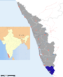 | ||||||
| Geography | |||||||
| Cities and Taluks |
| ||||||
| Transport | |||||||
| Education |
| ||||||
| Buildings | |||||||
| Culture | |||||||
| Lok Sabha constituencies | |||||||
| Sports | |||||||
| Museums | |||||||