Amaxades
| Amaxades Αμαξάδες | |
|---|---|
 Amaxades Location within the regional unit 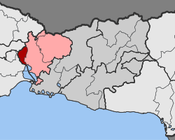 | |
| Coordinates: 41°07′N 25°04′E / 41.117°N 25.067°ECoordinates: 41°07′N 25°04′E / 41.117°N 25.067°E | |
| Country | Greece |
| Administrative region | East Macedonia and Thrace |
| Regional unit | Rhodope |
| Municipality | Iasmos |
| • Municipal unit | 34.3 km2 (13.2 sq mi) |
| Elevation | 52 m (171 ft) |
| Population (2011)[1] | |
| • Municipal unit | 1,773 |
| • Municipal unit density | 52/km2 (130/sq mi) |
| Time zone | UTC+2 (EET) |
| • Summer (DST) | UTC+3 (EEST) |
| Vehicle registration | ΚΟ |
Amaxades (Greek: Αμαξάδες, Bulgarian: Арабаджи, Turkish: Arabacıköy) is a village and a former community in the Rhodope regional unit, East Macedonia and Thrace, Greece. Since the 2011 local government reform it is part of the municipality Iasmos, of which it is a municipal unit.[2] The municipal unit has an area of 34.300 km2.[3] The population is 1,773 (2011). South of the village are the remains of the ancient town Anastasiopol (Anastasiopolis) later known as Peritheorion, Peritor (Bulgarian: Буроград) medieval fortress of the Bulgarian sebastocrator Momchil and center of the bishop of Anastasiopol in the Traianopol episcopy of the Constantinople Patriarchate.ref>ЕПАРХИЙСКИТЕ ЦЕНТРОВЕ И ТЕХНИТЕ КАТЕДРАЛИ</ref>[4]
References
- ↑ "Απογραφή Πληθυσμού - Κατοικιών 2011. ΜΟΝΙΜΟΣ Πληθυσμός" (in Greek). Hellenic Statistical Authority.
- ↑ Kallikratis law Greece Ministry of Interior (in Greek)
- ↑ "Population & housing census 2001 (incl. area and average elevation)" (PDF) (in Greek). National Statistical Service of Greece. Archived from the original (PDF) on 2015-09-21.
- ↑ Anastasioupolis
This article is issued from
Wikipedia.
The text is licensed under Creative Commons - Attribution - Sharealike.
Additional terms may apply for the media files.