Alubijid, Misamis Oriental
| Alubijid | ||
|---|---|---|
| Municipality | ||
| Municipality of Alubijid | ||
| ||
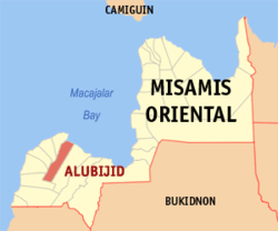 Map of Misamis Oriental with Alubijid highlighted | ||
.svg.png) Alubijid Location within the Philippines | ||
| Coordinates: 8°34′N 124°28′E / 8.57°N 124.47°ECoordinates: 8°34′N 124°28′E / 8.57°N 124.47°E | ||
| Country |
| |
| Region | Northern Mindanao (Region X) | |
| Province | Misamis Oriental | |
| District | 2nd District | |
| Barangays | 16 (see Barangays) | |
| Government [1] | ||
| • Type | Sangguniang Bayan | |
| • Mayor | Alvin Giovanni Labis | |
| • Electorate | 18,675 voters (2016) | |
| Area [2] | ||
| • Total | 85.56 km2 (33.03 sq mi) | |
| Population (2015 census)[3] | ||
| • Total | 29,724 | |
| • Density | 350/km2 (900/sq mi) | |
| Time zone | UTC+8 (PST) | |
| ZIP code | 9018 | |
| PSGC | 104301000 | |
| IDD : area code | +63 (0)88 | |
| Climate type | Tropical climate | |
| Income class | 4th municipal income class | |
| Revenue (₱) | 101,070,574.41 (2016) | |
| Native languages |
Cebuano Binukid Subanon language Tagalog | |
| Website |
www | |

Alubijid, officially the Municipality of Alubijid, is a 4th class municipality in the province of Misamis Oriental, Philippines. According to the 2015 census, it has a population of 29,724 people.[3]
Etymology and history
The municipality name, "Alubijid", pronounced alubihid due to Spanish accent, is the local term for the hog plum tree.
Alubijid, along with El Salvador, was part of Cagayan de Misamis (present-day Cagayan de Oro) when the two entities petitioned to become municipalities in 1933. Alubijid became a separate town in 1940, and El Salvador became one 9 years later.
Barangays
Alubijid is politically subdivided into 16 barangays.
- Baybay
- Benigwayan
- Calatcat
- Lagtang
- Lanao
- Loguilo
- Lourdes
- Lumbo
- Molocboloc
- Poblacion
- Sampatulog
- Sungay
- Talaba
- Taparak
- Tugasnon
- Tula
Demographics
| Population census of Alubijid | |||||||||||||||||||||||||||||||||||||||||||
|---|---|---|---|---|---|---|---|---|---|---|---|---|---|---|---|---|---|---|---|---|---|---|---|---|---|---|---|---|---|---|---|---|---|---|---|---|---|---|---|---|---|---|---|
|
| ||||||||||||||||||||||||||||||||||||||||||
| Source: Philippine Statistics Authority[3] [4] [5] [6] | |||||||||||||||||||||||||||||||||||||||||||
In the 2015 census, the population of Alubijid was 29,724 people,[3] with a density of 350 inhabitants per square kilometre or 910 inhabitants per square mile.
Schools
College:
- Bukidnon State University- Alubijid Extension
High schools:
- Alubijid National Comprehensive High School
- Lourdes National High School
- Living Hope Christian Academy (Private)
Elementary schools:
- Alubijid Central School
- Baybay Elementary School
- Benigwayan Elementary School
- Calatcat Elementary School
- Lagtang Elementary School
- Lanao Elementary School
- Loguilo Elementary School
- Lourdes Elementary School
- Lumbo Elementary School
- Molocboloc Elementary School
- Sampatulog Elementary School
- Sungay Elementary School
- Talaba Elementary School
- Taparak Elementary School
- Tugasnon Elementary School
- Tula Elementary School
References
- ↑ "Municipality". Quezon City, Philippines: Department of the Interior and Local Government. Retrieved 31 May 2013.
- ↑ "Province: Misamis Oriental". PSGC Interactive. Quezon City, Philippines: Philippine Statistics Authority. Retrieved 12 November 2016.
- 1 2 3 4 Census of Population (2015). "Region X (Northern Mindanao)". Total Population by Province, City, Municipality and Barangay. PSA. Retrieved 20 June 2016.
- ↑ Census of Population and Housing (2010). "Region X (Northern Mindanao)". Total Population by Province, City, Municipality and Barangay. NSO. Retrieved 29 June 2016.
- ↑ Censuses of Population (1903–2007). "Region X (Northern Mindanao)". Table 1. Population Enumerated in Various Censuses by Province/Highly Urbanized City: 1903 to 2007. NSO.
- ↑ "Province of Misamis Oriental". Municipality Population Data. Local Water Utilities Administration Research Division. Retrieved 17 December 2016.
External links
- Philippine Standard Geographic Code
- Philippine Census Information
- Local Governance Performance Management System
- Local Government Unit of Alubijid
Places adjacent to Alubijid, Misamis Oriental | |
|---|---|
Cagayan de Oro (capital) | |
| Municipalities | |
| Component cities | |
| Highly urbanized city |
|